Skip to content
JERSEY LIPERSONAL REAL ESTATE CORPORATION
Cariboo / North-East Burnaby

Cariboo, quietly positioned between the lake and the Tri-Cities.

Cariboo is one of Burnaby's most underestimated pockets. Draped across the hillside between Burnaby Lake and the Coquitlam border, it sits at the edge of the city in the best possible way — close to two SkyTrain stations, a short drive from Lougheed Town Centre, and directly beside one of Metro Vancouver's finest regional parks. The residential heart of the area, sometimes called Cariboo Heights, is made up of single-family homes, low-rise apartments, and townhomes set along quiet streets off Cariboo Road and Rochester Street. It does not have the crane-and-tower energy of Brentwood or Metrotown, and that is precisely the point. Families who want a real backyard, quick highway access to the Fraser Valley, and the option to walk to Burnaby Lake before breakfast have found a neighbourhood that larger parts of Burnaby have priced them out of. Cariboo is not a secret, but it is not overcrowded either — and for the right buyer, that gap is the opportunity.

Jersey LiSutton Group — 1st West RealtyMedallion ClubUpdated
Cariboo, Burnaby
HousingLow-rise condos, townhomes & single-family homes
MultiplexR1 SSMUH — 3–4 units (lots outside FTNA); 6 units near frequent transit
Quick Answer

Cariboo is a residential area in North-East Burnaby, centred around Cariboo Road and the slopes above Burnaby Lake, close to the Coquitlam border and North Road. Housing is a mix of single-family homes, low-rise apartments, and townhomes — less dense than the Burnaby town centres but with good SkyTrain access at Production Way–University and Lougheed Town Centre, strong park access at Burnaby Lake Regional Park, and quick Highway 1 entry for drivers heading to Coquitlam, Port Moody, or the Fraser Valley.

Key Takeaways
  • 01Cariboo sits in North-East Burnaby, between Burnaby Lake Regional Park and the Coquitlam / North Road border, with easy access to Highway 1.
  • 02Housing is predominantly low-rise condos, townhomes, and single-family homes — far less dense than the Burnaby town centres.
  • 03The closest SkyTrain stations are Production Way–University (Expo and Millennium Lines) and Lougheed Town Centre (Expo and Millennium Lines), both reachable by bus via Cariboo Road.
  • 04Burnaby Lake Regional Park, one of Metro Vancouver's largest regional parks, is directly accessible from the Cariboo Dam entrance on Cariboo Road.
  • 05The North Road corridor on the Burnaby–Coquitlam border is home to one of Canada's largest concentrations of Korean businesses, providing unique grocery, dining, and retail options within minutes.
  • 06Cariboo Hill Secondary School — known for its French Immersion program, Pre-Engineering Diploma, and notable alumni including Michael Bublé — is the area's public secondary school.
Your Cariboo Agent

Your Cariboo real estate agent — Jersey Li.

Cariboo is a Tri-Cities-border neighbourhood, and that geography shapes every buying decision here. Buyers who shortlist it are often weighing it against Port Moody, Coquitlam, or New Westminster at the same time, which means I am regularly doing side-by-side analysis across municipal lines — school district differences, strata fees in mixed-tenure buildings, Highway 1 commute patterns, and how Burnaby's Bill 44 R1 zoning reads against Coquitlam's equivalent rules. That cross-boundary knowledge is part of what I bring to Cariboo buyers.

The hillside single-family streets and the low-rise building stock along Manchester Drive and the Rochester Street cluster represent two different buyer stories. For the family buying a detached home, the conversation is about lot size, school catchment at Armstrong or Second Street Elementary, and redevelopment potential under the new R1 SSMUH rules. For the buyer looking at a condo or townhouse in the area, it is about strata health, proximity to the Burnaby Lake trail entrance, and what resale will look like in five to ten years relative to the town centres. I work both sides of that equation.

My honest read on Cariboo is that it suits buyers who want more space than Brentwood or Lougheed can give them, do not need to be directly at a SkyTrain station, and value the combination of nature access and Tri-Cities connectivity. It is not the right answer for someone whose priority is the shortest possible commute to downtown Vancouver. But for buyers who are realistic about transit time and want a quieter, greener base with genuine upside from redevelopment, it is a serious option that the market has not yet repriced to reflect that value.

  • Cross-boundary buyer advisory across Burnaby, Coquitlam, and Port Moody for clients drawn to the Tri-Cities corridor
  • Bill 44 / R1 SSMUH specialist — accurate lot-level analysis of what can be built in the Cariboo area under the 2024 rules
  • Fluent service in English, Mandarin, and Cantonese for Cariboo's diverse resident and buyer base
  • Medallion Club agent (top 10% REBGV) — Sutton Group — 1st West Realty
Jersey LiSutton Group — 1st West RealtyMedallion ClubLicensed (RECBC)
Work with Jersey in Cariboo
On This Page
(01)

The Cariboo Character

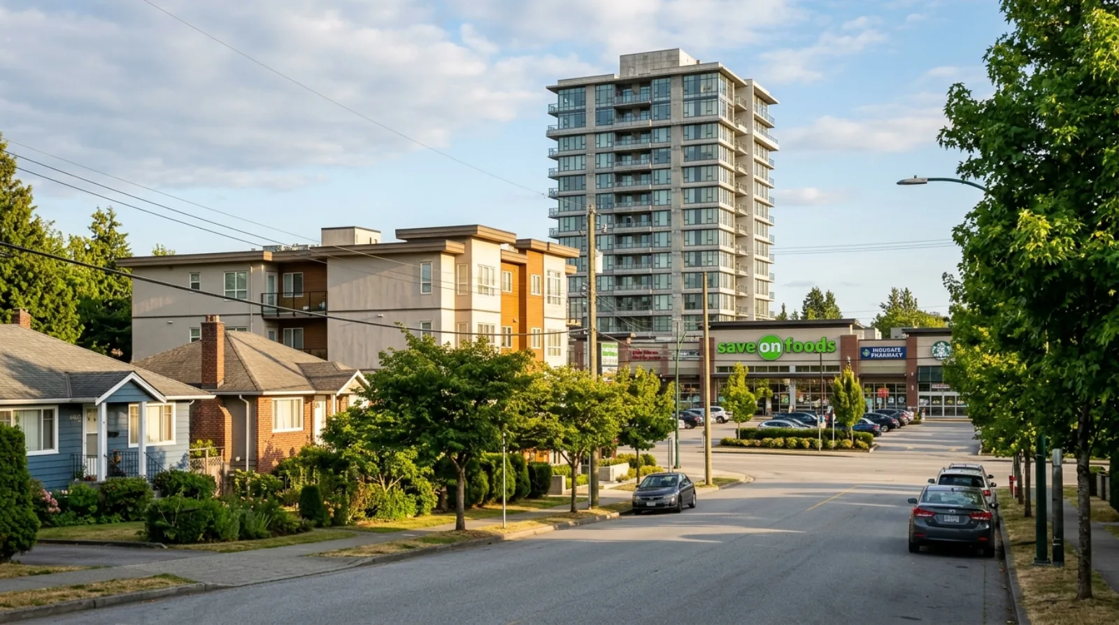
Cariboo occupies the north-eastern edge of Burnaby, where the city meets Coquitlam along North Road and the Brunette River corridor. The neighbourhood takes its name from Cariboo Road, the main spine that runs south from Lougheed Highway through the residential pocket and down to the Cariboo Dam entrance of Burnaby Lake Regional Park. North of Lougheed Highway, the industrial and commercial belt around Lake City Way acts as a natural boundary. South and east, the terrain drops toward the lake and the Brunette River, creating the forested buffer that gives this part of Burnaby its surprisingly open, semi-natural feel for a city this close to downtown Vancouver.

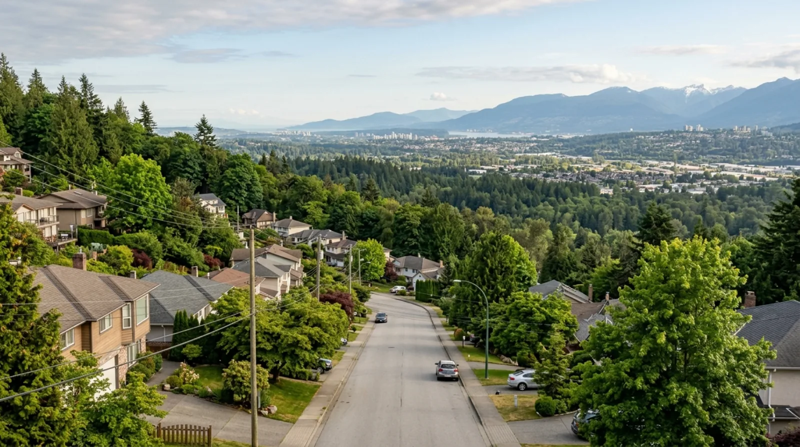
The residential core — sometimes called Cariboo Heights — sits on a gentle slope with views across the valley toward Coquitlam and the mountains to the north. Streets off Rochester Street and Cariboo Place are quiet and low-traffic by Burnaby standards. The housing stock is a mix: single-family detached homes built primarily from the 1960s through the 1980s, a cluster of low-rise concrete and wood-frame apartment buildings concentrated around Manchester Drive, and a smaller number of townhomes. There is no master-planned tower development here and no evident appetite for it — the scale of the neighbourhood is simply different from the town centres.

The community is diverse. The proximity to North Road's Koreatown — one of Canada's largest concentrations of Korean businesses, spanning both sides of the Burnaby–Coquitlam border — means Korean grocery stores, bakeries, restaurants, and services are within a short drive or bike ride. Long-term residents, families with children at Cariboo Hill Secondary, and newcomers to Metro Vancouver who want value relative to the town centres form a stable, mixed population that tends to stay rather than turn over rapidly.
(02)

The Real Estate Market

Cariboo's market is quieter in volume than the Burnaby town centres, which means fewer comparable sales at any given time and a wider range of outcomes depending on property type. The apartment and condo segment — concentrated in the low-rise buildings along Manchester Drive and nearby streets — represents the most accessible price point in the area, and has historically attracted first-time buyers, investors, and downsizers who want proximity to Burnaby Lake without the density of a high-rise. Townhouses and single-family detached homes trade far less frequently but draw families and upgrade buyers looking for space at a discount to Government Road or Simon Fraser Hills.

Because the neighbourhood is smaller and less frequently traded than Brentwood or Metrotown, pricing can be less predictable. A well-maintained detached home on a good lot can attract strong competition if inventory is thin; a dated condo in an older building can sit if the strata has deferred maintenance or a looming special levy. Buyers should read strata documents carefully on any low-rise purchase here — many of the buildings are from the 1970s and 1980s and have entered or are approaching major replacement cycles for roofing, plumbing, and envelope.

The redevelopment angle is real but not immediate. Under Burnaby's R1 SSMUH rules, most single-family lots in the Cariboo area can accommodate three to four units without FTNA proximity bonuses. For buyers who want to hold land with optionality, that is a meaningful change from the pre-2024 baseline, even if the economics of building small-scale multi-unit on a hillside lot require careful site-specific analysis.

(03)

Living in Cariboo

The rhythm of daily life in Cariboo is set by the park. Burnaby Lake Regional Park is not a small neighbourhood green space — it is a 290-hectare regional park managed by Metro Vancouver, with a 10-kilometre walking loop, extensive boardwalks over the lake wetlands, a Nature House at Piper Spit with birdwatching platforms, and the Cariboo Dam at the eastern end where the lake drains into the Brunette River. The Cariboo Dam entrance on Cariboo Road is the closest access point for residents of this neighbourhood. On a weekday morning the trail is quiet; on a summer weekend the loop fills with families, trail runners, and birders spotting great blue herons, wood ducks, and the occasional green-backed heron. For residents who value green space as a daily amenity rather than a special-occasion drive, Cariboo delivers it from the front door.

Highway 1 access at Cariboo Road or Kensington Avenue makes Cariboo attractive for anyone whose life pulls toward Coquitlam, Port Moody, the Tri-Cities, or the Fraser Valley on a regular basis. This is unusual for a Burnaby neighbourhood — most of the city orients westward toward Vancouver, but Cariboo genuinely works as a base for residents whose work or family is spread across the eastern end of Metro Vancouver.

The North Road Koreatown corridor, two minutes east by car, provides a grocery-and-dining ecosystem unlike anything else in this part of the region — Hannam Supermarket, Korean bakeries, noodle houses, and a concentration of Korean health and wellness businesses that draws shoppers from across the Lower Mainland. For residents who shop and eat in this ecosystem regularly, it is a serious quality-of-life advantage.

The honest tradeoff is that Cariboo is transit-dependent in a way that requires a bus connection to the SkyTrain rather than a walk. Production Way–University and Lougheed Town Centre stations are the nearest nodes, but both require a bus along Cariboo Road or Lougheed Highway. If you need to be on a SkyTrain platform in under five minutes from your front door, Cariboo is not the right fit.

(04)

Redevelopment & Multiplex Outlook

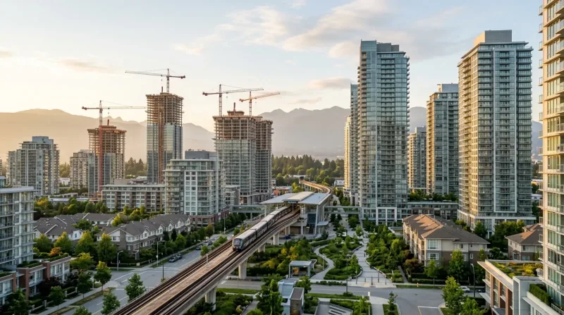
Cariboo's development story in 2026 is shaped primarily by Burnaby's adoption of the R1 SSMUH zone in response to BC's Bill 44. The old single-family-only zoning is gone. Most detached lots in the Cariboo residential area now permit three to four dwelling units as of right, meaning without a rezoning application — the number depends on lot size and whether the property falls within a Frequent Transit Network Area (FTNA).

The Cariboo residential pocket sits at some distance from the Frequent Transit Network corridors that run along Lougheed Highway and North Road. This means that most interior streets in the neighbourhood fall into the three-to-four unit category rather than the six-unit maximum that applies to lots within walking distance of frequent transit. Buyers or owners weighing a multiplex project should verify their specific lot's status against the current Burnaby R1 SSMUH zoning map — lot area and FTNA proximity both matter, and the rules require a site-by-site read, not a neighbourhood generalisation.

The low-rise apartment buildings from the 1970s and 1980s are a separate conversation. They sit on larger parcels that could attract developer interest over time, particularly as the corridor between Lougheed Town Centre and North Road continues to mature. For now, the majority of these buildings are in the hands of long-term strata owners with no immediate disposition appetite, but the land-value shift from R1 is real and will put pressure on assembly discussions as the decade progresses.

(05)

Parks and Nature Access

Burnaby Lake Regional Park is the defining natural amenity of this neighbourhood. The Cariboo Dam entrance, reached via Cariboo Road, puts residents directly on the eastern edge of the 10-kilometre lake loop. The park encompasses the lake itself — formed by a glacier approximately 12,000 years ago — and its surrounding wetlands, with over 400 documented species of plants, birds, fish, mammals, reptiles, and amphibiles. The Brunette River flows out of the lake at the Cariboo Dam, and the dam area has its own short trail system and viewing spots.

For residents who want a longer walk, the full loop connects westward to the Piper Spit area and the Nature House, where the Metro Vancouver naturalist staff run educational programs and maintain washroom facilities. The Central Valley Greenway, the major east-west cycling and walking route through Burnaby, passes near the south edge of the park and connects through to New Westminster in one direction and East Vancouver in the other.

Burnaby Mountain Golf Course is located in this part of north Burnaby at 7600 Halifax Street — a publicly accessible City of Burnaby facility with a full 18-hole course and a driving range, consistently ranked among the most popular public courses in the Lower Mainland.

(06)

Cariboo vs Lougheed vs Government Road

Buyers who shortlist Cariboo are often also looking at the Lougheed Town Centre area and the Government Road neighbourhood. Each serves a meaningfully different buyer profile, and the differences are worth naming clearly before any offer is made.

Lougheed Town Centre, one stop west on the Expo and Millennium Lines, is a master-planned urban node at an early stage of its build-out. The City of Lougheed development is adding towers and retail alongside the existing Lougheed Town Centre mall. Entry pricing for condos at Lougheed is generally lower than in Brentwood, and investors with a long horizon often prefer it precisely because the neighbourhood is not finished. Cariboo, by contrast, is not a tower market at all — the density here is much lower, the lifestyle more suburban, and the upside story is about land and quiet rather than about watching a neighbourhood transform.

Government Road is the premium single-family enclave between Burnaby Lake and Burnaby Mountain, bordered roughly by Lougheed Highway to the north, Gaglardi Way to the east, and Kensington Avenue through the park to the west. It is one of Burnaby's most desirable residential streets, with large lots, mature trees, and significant detached home prices that sit well above the Burnaby average. Cariboo shares the same park access and the same northerly orientation, but at a lower price point and with a more varied housing mix. For buyers who want Government Road's lifestyle but cannot stretch to Government Road's pricing, Cariboo is the natural adjacent consideration.

(07)

What to Watch For When Buying in Cariboo

In the low-rise condo and apartment segment, the age of the building is the central risk factor. Buildings from the 1970s and 1980s on Manchester Drive and nearby streets have been through or are approaching their first full replacement cycles for roofing, envelope, plumbing, and mechanical systems. Before making an offer, read the depreciation report in full, check the contingency fund balance against the estimated repair schedule, and review the last three years of strata minutes for any discussion of assessments or deferred maintenance. A building with a low strata fee and an underfunded reserve is not a bargain — it is a deferred special levy.

For single-family and townhome buyers, the slope matters. Parts of Cariboo Heights sit on ground with meaningful grade. Drainage, foundation condition, and any retaining wall maintenance on hillside lots deserve a careful look during the inspection, and your inspector should be someone who understands sloped-lot risks specifically.

Transit realism is important. If your lifestyle requires a daily SkyTrain commute, calculate your actual door-to-platform time with a bus connection along Cariboo Road to Production Way–University or Lougheed Town Centre. In peak hours the connection adds fifteen to twenty minutes each way compared to walking directly to a station. That is manageable for many buyers, but it should be in the decision, not discovered after possession.

Highway 1 access is a genuine strength but cuts both ways on noise. Homes on or near the Lougheed Highway side of the neighbourhood can experience traffic noise, particularly from the highway ramps. Inspect your specific property for highway sound, not just the neighbourhood in general.

(08)

My Take as Your Advisor

Cariboo works well for a buyer who is honest with themselves about priorities. The buyers I tend to place here successfully are families who want a real yard and real park access — where Burnaby Lake is literally the backyard — and who are prepared to drive or bus to the SkyTrain rather than walk to it. They usually have at least one car, they may work in the Tri-Cities or travel Highway 1 regularly, and they want more space than a condo in the town centres can give them for the same money.

The buyers I tend to steer elsewhere are those who tell me transit is their primary constraint. If a ten-minute walk to a SkyTrain platform is non-negotiable, Cariboo will frustrate you and you will eventually wish you had bought closer to a station. There are better answers for that profile in Burnaby and in New Westminster.

On the investment side, Cariboo is a patient play. The R1 changes have added a real floor of redevelopment value under single-family lots, and the long-term pressure from the Lougheed corridor and the North Road Koreatown vitality will push attention eastward over time. But this is not a neighbourhood that will reprice in a year or two. It suits buyers who are planning to live in the home for five years or more and who see the land optionality as a bonus, not the primary thesis.

Getting Around

Commute times from Cariboo.

SkyTrain figures are in-vehicle times from TransLink's official station-to-station chart; add a few minutes for transfers and waiting. Bus and nearest-station legs are noted per row. Driving times are approximate and off-peak.

DestinationBy TransitBy Car
Lougheed Town Centre (bus + SkyTrain hub)The most practical transit anchor for most Cariboo residents.Approx. 10–15 min by bus on Route 101 from Cariboo Road stops.≈5–8 min off-peak
Production Way–University StationExpo and Millennium Line interchange; #145 bus to SFU departs from here.Approx. 10–15 min by bus on Route 101 or 145 from Cariboo Road.≈8–12 min off-peak
Downtown Vancouver (Waterfront Station)Add 10–15 min to reach Lougheed Station by bus before boarding the SkyTrain.≈40 min in-vehicle on the Expo Line from Lougheed Town Centre Station, plus bus connection time to the station.≈30–40 min off-peak via Highway 1
Coquitlam / Tri-CitiesThe closest Burnaby neighbourhood to Coquitlam's town centre.Bus connections from Lougheed Station to Coquitlam Central or Port Moody; times vary by destination.≈10–15 min to central Coquitlam via North Road or Highway 1
SFU (Burnaby Mountain)Bus #145 from Production Way–University Station up the mountain — approx. 20 min on campus-bound bus plus travel to station.≈15–20 min off-peak via Gaglardi Way
MetrotownExpo Line from Lougheed Town Centre Station to Metrotown — approximately 20 min in-vehicle, plus bus to station.≈20–25 min off-peak
Side by Side

Cariboo vs Lougheed Town Centre vs Government Road: three different North-East Burnaby options.

CaribooLougheed Town CentreGovernment Road
Primary housing typeLow-rise condos, townhomes, single-familyCondos + new master-planned towersDetached single-family (large lots)
SkyTrain accessBus connection to Production Way or Lougheed (~10–15 min)Walk to Lougheed Town Centre StationBus connection; no walk-to-station option
Park / nature accessBurnaby Lake — Cariboo Dam entrance on doorstepLougheed Town Centre mall area; Burnaby Lake is a drive or busBetween Burnaby Lake and Burnaby Mountain — excellent
DensityLow — neighbourhood scaleHigh and growing — master-planned urban nodeVery low — single-family only
Multiplex potential (Bill 44 / R1)3–4 units on most lots (outside FTNA)High-density zoning already; limited R1 applicability3–6 units depending on FTNA proximity
Tri-Cities / Highway 1 accessExcellent — direct ramps via Cariboo Rd / KensingtonGood — Lougheed Hwy east to Coquitlam borderGood — Gaglardi Way to Highway 1

SkyTrain travel times are in-vehicle minutes from TransLink's Expo Line station data; add transfer and wait time. R1 SSMUH unit counts depend on lot size and FTNA proximity — verify at the parcel level.

Multiplex Outlook

What multiplex means for this neighborhood.

Under Burnaby's R1 SSMUH zone — adopted in June 2024 in response to BC's Bill 44 — most single-family lots in the Cariboo residential area now permit three to four dwelling units as of right. Properties that fall within a Frequent Transit Network Area (FTNA) may qualify for up to six units, but much of the Cariboo interior falls outside the FTNA corridor and sits in the three-to-four unit category. Lot area also affects the unit count: lots up to 280 m² permit up to three units; larger lots permit four units (outside FTNA). Any specific project requires a site-by-site review of the current zoning map and lot measurements — neighbourhood-level generalisations can be misleading given how the FTNA boundaries are drawn. I can walk through the R1 rules for any specific property in Cariboo as part of a buyer or seller consultation.

Multiplex Advisory →
The Local Map

What's around you.

Cariboo — approximate centre · map © OpenStreetMap contributorsView larger map ↗

Schools

  • Cariboo Hill Secondary School — The area's public secondary (grades 8–12) at 8580 16th Ave; offers French Immersion, Pre-Engineering Diploma, and IT Academies; notable alumni include Michael Bublé
  • Armstrong Elementary School — One of two feeder elementary schools in the Cariboo Hill family of schools
  • Second Street Elementary School — The other primary feeder school for Cariboo Hill Secondary in School District 41
  • Lakeview Elementary School — Additional elementary school in the Cariboo-Lougheed school zone of School District 41 Burnaby

Parks & Recreation

  • Burnaby Lake Regional Park — Cariboo Dam entrance — The closest access point for Cariboo residents; trail connects to the full 10 km lake loop, wetlands boardwalks, and nature viewing
  • Burnaby Lake Regional Park — Piper Spit — Western entrance with the Nature House, birdwatching platform into the lake, and washrooms; reachable on foot via the loop
  • Central Valley Greenway — Major east-west multi-use trail connecting New Westminster to East Vancouver; passes near the south edge of Burnaby Lake Park
  • Burnaby Mountain Golf Course — City of Burnaby public 18-hole course and driving range at 7600 Halifax St, north Burnaby — one of the most popular public courses in the Lower Mainland
  • Brunette River Trail — Follows the Brunette River from the Cariboo Dam outlet toward New Westminster; accessible from the Cariboo Dam area

Transit

  • Production Way–University Station (Expo & Millennium Lines) — Nearest SkyTrain interchange; reached by bus along Cariboo Road or Lougheed Highway; direct Expo Line service to downtown Vancouver
  • Lougheed Town Centre Station (Expo & Millennium Lines) — Second major SkyTrain interchange, walkable from the Lougheed Highway / Cariboo Road area; Millennium Line to VCC–Clark and Expo Line to Waterfront
  • TransLink Route 101 — Bus connecting Lougheed Station with 22nd Street Station via Cariboo Road — primary surface transit spine for the neighbourhood
  • TransLink Route 145 — Serves Production Way–University Station and connects to SFU; stops accessible from the Cariboo Road corridor
  • Highway 1 access via Cariboo Road and Kensington Avenue — Direct on-ramp access for drivers heading east to Coquitlam and Port Moody or west toward Vancouver via the Trans-Canada

Shopping & Dining

  • Lougheed Town Centre — Regional mall and retail hub at Lougheed Station — two stops west — with grocery, department store, dining, and services
  • Korea Town Centre / North Road Centre (4501 North Rd, Burnaby) — One of Canada's largest concentrations of Korean businesses; includes Hannam Supermarket, Korean bakeries, restaurants, and health services along both sides of North Road
  • North Road Koreatown corridor — Approximately 180 Korean businesses lining North Road from Austin Avenue southward on the Burnaby–Coquitlam border
  • Cariboo Centre (Coquitlam side of North Road) — Neighbourhood retail centre on the Coquitlam side of North Road, steps from the Burnaby border, with Korean dining and grocery tenants
  • Lougheed Highway commercial strip — Grocery, pharmacy, fast food, and service retail along Lougheed Highway west of Cariboo Road
Who Thrives Here

Who this neighborhood suits.

Frequently Asked

Questions buyers ask about Cariboo.

Where exactly is the Cariboo neighbourhood in Burnaby?

+

Cariboo is in North-East Burnaby, centred around Cariboo Road and the residential streets off Rochester Street and Cariboo Place. It sits between Lougheed Highway to the north, Burnaby Lake Regional Park to the south, and the Coquitlam border (North Road) to the east. It is not the same as the Cariboo region of interior BC — it is a small urban neighbourhood within the City of Burnaby.

What SkyTrain stations serve the Cariboo area?

+

The two nearest SkyTrain stations are Production Way–University Station and Lougheed Town Centre Station, both of which are served by both the Expo Line and the Millennium Line. Neither is within walking distance for most Cariboo residents — a bus connection via Route 101 or Route 145 along Cariboo Road or Lougheed Highway takes approximately 10 to 15 minutes. If walking to a SkyTrain platform is essential for your daily routine, Cariboo will require an adjustment.

Is Cariboo a good neighbourhood for families?

+

Cariboo is one of Burnaby's stronger options for families who want more space and immediate park access. The area has a mix of detached homes and townhomes, Burnaby Lake Regional Park is directly accessible from the Cariboo Dam entrance, and the local secondary school — Cariboo Hill Secondary — has well-regarded programs including French Immersion, a Pre-Engineering Diploma, and sports academies. The feeder elementary schools are Armstrong Elementary and Second Street Elementary. Families who value nature access, a quieter residential scale, and reasonable property prices relative to other Burnaby areas tend to do well here.

What is Cariboo Hill Secondary School known for?

+

Cariboo Hill Secondary is a public school serving grades 8 to 12 at 8580 16th Avenue in Burnaby. It is the smallest high school in Burnaby by enrollment. The school offers a French Immersion program, a Pre-Engineering Diploma Program, an Elite Volleyball Academy, Boys' Field Lacrosse Academy, and IT Academies focused on gaming and cybersecurity. Its most widely known alumnus is singer Michael Bublé.

How close is Cariboo to Burnaby Lake Regional Park?

+

Very close. The Cariboo Dam entrance to Burnaby Lake Regional Park is accessed directly from Cariboo Road, making it the most convenient point of entry for Cariboo residents. From there, the 10-kilometre walking loop around the lake begins immediately, with trail connections to Piper Spit on the west side and the Brunette River on the east. The park is a Metro Vancouver regional park — free to enter, open year-round, with boardwalks, viewing platforms, and a Nature House staffed by naturalists.

Can I build a multiplex on a lot in Cariboo?

+

Burnaby's R1 SSMUH zone, adopted in June 2024 under Bill 44, allows most single-family lots in Cariboo to be redeveloped into three or four units without a rezoning application. Whether you qualify for three or four units depends on your lot area, and whether your lot is within a Frequent Transit Network Area (FTNA) determines whether six units are possible. Most of the Cariboo residential interior falls outside the FTNA and therefore sits in the three-to-four unit range. I can review the specifics for any lot as part of a buyer or seller consultation.

What shopping is near Cariboo, Burnaby?

+

The closest large retail hub is Lougheed Town Centre, about five minutes west by car or bus. For grocery and dining, the North Road Koreatown corridor — right on the Burnaby–Coquitlam border, a two-minute drive east — has one of the largest concentrations of Korean businesses in Canada, including Hannam Supermarket, Korean bakeries, restaurants, and health services. Cariboo Centre on the Coquitlam side of North Road adds additional options. There is no significant independent retail or main street within walking distance of the Cariboo residential pocket itself.

How long does it take to commute from Cariboo to downtown Vancouver?

+

From most addresses in the Cariboo residential area, reaching downtown Vancouver by transit takes approximately 50 to 60 minutes door to door on a typical weekday. This includes a bus connection of 10 to 15 minutes to Lougheed Town Centre Station, then approximately 40 minutes in-vehicle on the Expo Line to Waterfront Station. By car, the drive via Highway 1 is roughly 30 to 40 minutes off-peak, though peak-hour traffic on Highway 1 and the Cassiar or Second Narrows crossing can extend this significantly. Cariboo is not the right address for someone who needs the shortest possible transit commute to downtown Vancouver.

How does Cariboo compare to Government Road in Burnaby?

+

Government Road is one of Burnaby's most prestigious single-family enclaves, with large lots, mature trees, and home prices that sit well above the Burnaby average. It sits between Burnaby Lake and Burnaby Mountain, with excellent park access and a very quiet residential character. Cariboo shares the park adjacency and the North-East Burnaby orientation, but at a lower price point and with a more varied housing mix that includes low-rise condos and townhomes alongside detached homes. For buyers who want Government Road's lifestyle but need a more accessible entry price, Cariboo is the natural adjacent neighbourhood to consider.

Is the North Road Koreatown near Cariboo?

+

Yes. North Road forms the Burnaby–Coquitlam border just east of Cariboo, and the Koreatown corridor along North Road — sometimes called K-Town — runs roughly from Austin Avenue southward and contains approximately 180 Korean businesses on both sides of the border. This includes Hannam Supermarket at Korea Town Centre (4501 North Rd, Burnaby), Korean bakeries, restaurants, clinics, and specialty retailers. It is a two-to-three minute drive from the Cariboo residential area and is a genuine quality-of-life advantage for residents who use the Korean retail and dining ecosystem regularly.

Keep Exploring

Other Burnaby neighborhoods.

Free · No Obligation

What's your Cariboo home worth today?

Get a data-driven valuation from a local Burnaby expert — not an automated guess.

Considering Cariboo?

Let's talk about your Cariboo move.

Whether you're buying, selling, or weighing a multiplex play, I'll give you the straight read. No pressure, no obligation.

Book a Consultation
CallFree Valuation