Skip to content
JERSEY LIPERSONAL REAL ESTATE CORPORATION
Sullivan Heights / Northeast Burnaby

Sullivan Heights, northeast Burnaby's transit-connected family neighbourhood.

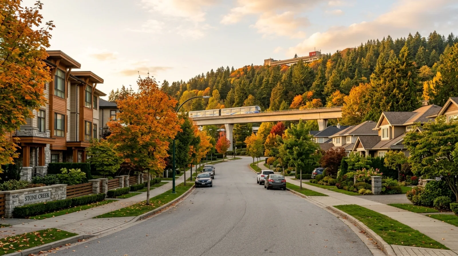
Sullivan Heights sits in northeast Burnaby, north of Lougheed Highway and south of Simon Fraser University (SFU) on Burnaby Mountain. It stretches east of the Government Road area toward North Road, the road that divides Burnaby from Coquitlam, and it borders Coquitlam and Port Moody, with the western edge of Coquitlam here colloquially called Burquitlam. What you find inside those boundaries is a diverse, growing, family-friendly community: older single-family homes on the residential streets, plus newer townhomes and condominium development, especially closer to Lougheed Town Centre. The neighbourhood is unusual for how well connected it is: two SkyTrain stations serve the area (Lougheed Town Centre Station and Burquitlam Station), The City of Lougheed shopping centre is on the doorstep, and SFU is a short trip up Burnaby Mountain to the north. Stoney Creek, a salmon-bearing creek and ravine, runs through the area and gives Stoney Creek Community School its name. It is a rare combination for Burnaby: everyday shopping and dining within reach, two rapid-transit options, and a genuine mix of housing types that suits first-time buyers, growing families, and long-term owners alike.

Jersey LiSutton Group - 1st West RealtyMedallion ClubUpdated
Sullivan Heights, Burnaby
HousingMix of detached homes on residential streets, plus townhomes and condos near Lougheed Town Centre
MultiplexRS residential streets under Bill 44; higher-density transit-oriented zoning near Lougheed Town Centre
Quick Answer

Sullivan Heights is a diverse, family-friendly neighbourhood in northeast Burnaby, north of Lougheed Highway and south of Simon Fraser University (SFU) on Burnaby Mountain. It borders Coquitlam and Port Moody, near the area colloquially called Burquitlam. Housing is a mix of older single-family detached homes on the residential streets, with newer townhome and condo density near Lougheed Town Centre. Two SkyTrain stations serve the area: Lougheed Town Centre Station (an Expo Line / Millennium Line interchange) and Burquitlam Station (Millennium Line). The City of Lougheed is the main shopping and dining hub. Stoney Creek Community School, Lyndhurst Elementary, and Cameron Elementary serve K to 7; Burnaby Mountain Secondary is the feeder secondary school.

Key Takeaways
  • 01Sullivan Heights is a residential neighbourhood in northeast Burnaby, north of Lougheed Highway, south of SFU on Burnaby Mountain, east of the Government Road area, and west of North Road on the Burnaby-Coquitlam border.
  • 02Housing is a genuine mix: older single-family detached homes on the residential streets, with newer townhomes and condominiums closer to Lougheed Town Centre.
  • 03Two SkyTrain stations serve the area: Lougheed Town Centre Station (an Expo Line / Millennium Line interchange) and Burquitlam Station (Millennium Line, on the Evergreen Extension toward Port Moody and Coquitlam).
  • 04The City of Lougheed (Lougheed Town Centre) is the neighbourhood's main retail and dining hub, with grocery, pharmacy, restaurants, cafes, and boutique eateries.
  • 05Stoney Creek Community School (K to 7), Lyndhurst Elementary (K to 7), and Cameron Elementary (K to 7) serve the area, with Burnaby Mountain Secondary as the feeder secondary school (grades 8 to 12).
  • 06Zoning is split: standard RS residential streets fall under BC's Bill 44 multiplex rules, while land close to Lougheed Town Centre sits in higher-density transit-oriented zoning, a genuinely different redevelopment picture.
Your Sullivan Heights Agent

Your Sullivan Heights real estate agent, Jersey Li.

Sullivan Heights is one of the more varied markets in Burnaby, and that variety is exactly why it needs a careful read. A detached home on a quiet RS street, a townhome a few blocks from Burquitlam Station, and a condo above Lougheed Town Centre are three completely different products with three completely different buyer pools and valuation approaches. I value each on its own terms: the detached home on land and lot potential, the townhome on layout and strata health, the condo on floorplan, view, and building. A single neighbourhood average tells you almost nothing here, which is why getting a property-specific read matters whether you are buying or selling.

The dual-station transit access is a real and measurable value driver in this area. Lougheed Town Centre Station connects the Expo Line and the Millennium Line, and Burquitlam Station puts you on the Millennium Line toward Port Moody, Coquitlam, Brentwood, and downtown-direction transfers. Proximity to either station affects price, resale demand, and rental appeal, and it is not the same as simply being near Lougheed Highway. I can tell you exactly what the walk to each station means for a specific address, and how much that connection actually adds.

The land closest to Lougheed Town Centre sits in higher-density transit-oriented zoning, a genuinely different redevelopment picture from the quiet single-family streets a short distance away. On the residential streets, BC's Bill 44 legislation added baseline multiplex rights, but what your specific lot supports depends on its dimensions, the creek and ravine setbacks near Stoney Creek, and Burnaby's own rules. I walk through what your parcel actually allows, an honest, lot-by-lot read, rather than quoting the legislation in general terms.

Whether you are a first-time buyer looking at a condo near the mall, a family wanting a detached home and a yard on a residential street, or an owner deciding how to position a townhome for sale, I will give you a straight read, no pressure, no optimism that is not supported by evidence, and a clear answer for current pricing rather than a guess. Contact Jersey Li for current market data on any specific property type here.

  • Multi-product valuation across northeast Burnaby, detached homes, townhomes, and transit-adjacent condos each read on their own terms, not on a single neighbourhood average
  • Clear guidance on how proximity to Lougheed Town Centre Station and Burquitlam Station affects price, resale, and rental demand for a specific address
  • Fluent service in English, Mandarin, and Cantonese for the diverse buyer base drawn to northeast Burnaby's family-oriented neighbourhoods
  • Medallion Club agent (top 10% REBGV), Sutton Group - 1st West Realty
Jersey LiSutton Group - 1st West RealtyMedallion ClubLicensed (RECBC)
Work with Jersey in Sullivan Heights
On This Page
(01)

The Sullivan Heights Character

Sullivan Heights is the kind of northeast Burnaby neighbourhood that quietly does a lot of things well at once. It is family-friendly and diverse, it is close to SFU up Burnaby Mountain, and it sits right on the Coquitlam and Port Moody border where the western edge of Coquitlam is colloquially called Burquitlam. Drive the residential streets and you find established single-family homes; move toward Lougheed Highway and Lougheed Town Centre and the density rises into newer townhomes and condominium towers. It is a neighbourhood in transition, in the best sense, the older character streets remain, while new housing has grown up around the transit and retail hub.

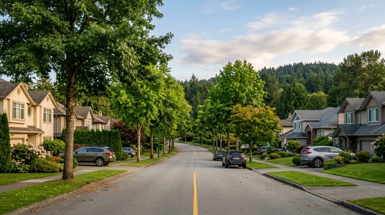
The housing stock reflects that mix directly. On the quieter residential streets you find older single-family detached homes, many on standard RS lots. Closer to the mall and the SkyTrain, newer townhouse and condominium development has added density and a different kind of buyer, first-time owners, downsizers, and households who want everything within walking distance. This range of housing types is one of the area's defining features and sets it apart from Burnaby neighbourhoods that are almost entirely one product.

The area's geographic position is worth understanding precisely. To the north is SFU on Burnaby Mountain, with the Burnaby Mountain Conservation Area and university trails accessible up the mountain. To the south is Lougheed Highway. To the east is North Road, the boundary between Burnaby and Coquitlam, with the Burquitlam edge of Coquitlam and Port Moody just beyond. To the west is the Government Road area. The result is a neighbourhood that is genuinely connected, to the university, to two SkyTrain lines, to a major mall, and to the wider Tri-Cities on the Coquitlam side.

What sets Sullivan Heights apart from Burnaby's quieter enclaves is convenience. Two SkyTrain stations, The City of Lougheed on the doorstep, and the North Road restaurant and grocery corridor along the Burnaby-Coquitlam border mean daily life here does not depend on a long drive. For buyers who want a family neighbourhood without giving up walkable shopping and rapid transit, that combination is the whole point.
(02)

Stoney Creek, the Ravine, and SFU Trails

The natural feature that gives the neighbourhood its identity is Stoney Creek, a salmon-bearing creek and ravine that runs through the area and gives Stoney Creek Community School its name. A salmon-bearing creek in the middle of a growing urban neighbourhood is genuinely uncommon, and the ravine that carries it provides green space, a natural corridor, and a sense of place that newer high-density areas often lack. For families, the creek and its ravine are part of the daily backdrop rather than a distant park you have to drive to.

To the north, the neighbourhood's relationship with Burnaby Mountain is a real amenity. The Burnaby Mountain Conservation Area and the SFU trails are accessible up the mountain, giving residents access to forest trails, viewpoints, and a large protected natural area within reach of home. This is the same mountain that carries SFU at its summit, so the trails and the university are part of the same geography to the north of Sullivan Heights.

For Sullivan Heights residents, this mix of a creek-and-ravine corridor through the neighbourhood and a mountain conservation area up the slope means green space is close at hand even as the area grows denser near the mall. It is part of what keeps the neighbourhood feeling family-friendly rather than purely urban, and it is a point worth walking through in person when you are comparing specific streets.

(03)

The Real Estate Market

Sullivan Heights is a mixed-product market, and that is its defining characteristic. Unlike neighbourhoods that are almost entirely detached homes or almost entirely condos, Sullivan Heights offers established single-family detached homes on the residential streets alongside newer townhomes and condominiums near Lougheed Town Centre. Each of these is a different market with a different buyer pool, and each needs its own valuation approach rather than a single neighbourhood number.

The detached homes on the residential streets tend to attract families who want space, a yard, and long-term roots while staying close to transit and the mall. The townhomes and condos closer to Lougheed Town Centre attract first-time buyers, downsizers, and households who prioritise walkable convenience and quick SkyTrain access. Pricing for the detached homes reflects land and lot potential as much as the house itself; pricing for the townhomes and condos reflects layout, floor level, view, building quality, and strata health.

Because the neighbourhood spans such a wide range of housing types, and because the client's guidelines prohibit publishing price ranges without a verified current source, interested buyers should contact Jersey Li directly for a current market read on a specific property type, detached, townhome, or condo. What can be said clearly is that proximity to the two SkyTrain stations and to Lougheed Town Centre is a genuine value factor across all three product types.

Demand is driven by the neighbourhood's connectivity: families and buyers who want rapid transit on two lines, everyday shopping on the doorstep, SFU nearby, and access to the wider Tri-Cities across the Coquitlam border, all in a family-friendly northeast Burnaby setting.

(04)

Living in Sullivan Heights

Daily life in Sullivan Heights is built around convenience. The City of Lougheed (Lougheed Town Centre) is the neighbourhood's main retail and dining hub, with grocery, pharmacy, restaurants, cafes, and boutique eateries all in one place. For many residents, the weekly grocery run, a pharmacy stop, and a coffee or a meal out are all reachable on foot or a short trip, a very different rhythm from Burnaby's car-dependent enclaves.

Along North Road, on the Burnaby-Coquitlam border, there is a well-known Korean restaurant and grocery corridor. This corridor is a real draw for the neighbourhood and the wider area, a concentration of Korean dining and grocery options that gives Sullivan Heights a distinct food culture on its eastern edge. It is one of the amenities residents mention first when they describe what they like about living here.

The two SkyTrain stations shape the lifestyle as much as the shopping does. Lougheed Town Centre Station connects the Expo Line and the Millennium Line, and Burquitlam Station puts residents on the Millennium Line toward Port Moody and Coquitlam on the Evergreen Extension. That means a resident can reach Brentwood, downtown-direction transfers, and the Tri-Cities without a car, a level of transit access that is rare for a family neighbourhood.

The neighbourhood's family-friendly character comes through in its schools, the Stoney Creek ravine, and the mix of quiet residential streets with newer housing near the hub. It suits households who want the day-to-day ease of shopping and transit close by, while keeping the green space and school access of a real neighbourhood. For buyers weighing a specific street, walking the area at different times of day is worth doing before deciding.

(05)

Redevelopment, Bill 44 & Transit-Oriented Zoning

Sullivan Heights has two distinct zoning stories, and telling them apart matters for anyone thinking about redevelopment. The standard residential streets fall under RS single-family zoning, which is subject to BC's Bill 44 small-scale multi-unit housing legislation. Bill 44 grants baseline multiplex rights, up to four or six units depending on lot characteristics, across most of BC's urban residential zones, including these streets.

Land close to Lougheed Town Centre is a different picture entirely. That area sits in higher-density transit-oriented zoning (CD / RM and related designations), reflecting its position beside a major mall and an Expo Line / Millennium Line interchange. The redevelopment potential there is genuinely different from the quiet single-family streets a short distance away, higher density, a different scale of building, and a different set of rules and processes.

For buyers evaluating redevelopment potential on a specific Sullivan Heights property, the first question is always which zoning story your parcel belongs to. A detached lot on an RS street is a Bill 44 multiplex question governed by lot dimensions, setbacks, and any creek or ravine constraints near Stoney Creek. A parcel near the mall is a transit-oriented density question governed by a different framework. I run through this analysis lot by lot, looking at the actual zoning, not a neighbourhood generalisation, as a standard part of my buyer advisory process here.

Most Sullivan Heights buyers are purchasing to live in, whether that is a detached home, a townhome, or a condo. The redevelopment optionality matters most to those specifically evaluating a lot for a build or a longer-term hold. Understanding which zoning story applies to a property is part of knowing exactly what you own, and it is genuinely different depending on where in the neighbourhood you are.

(06)

Sullivan Heights vs Lougheed vs Government Road

Buyers who shortlist Sullivan Heights often look at the Lougheed area and Government Road in the same search. All three are northeast Burnaby options, but they serve very different priorities, and mapping the differences clearly helps before making a decision.

The Lougheed area, centred on The City of Lougheed and Lougheed Town Centre Station, is the most urban and transit-dense of the three. It is dominated by condominium towers and mixed-use development right at the Expo Line / Millennium Line interchange, with everything walkable. It suits buyers who want maximum convenience and rapid transit at the door, and who are comfortable in a high-density setting.

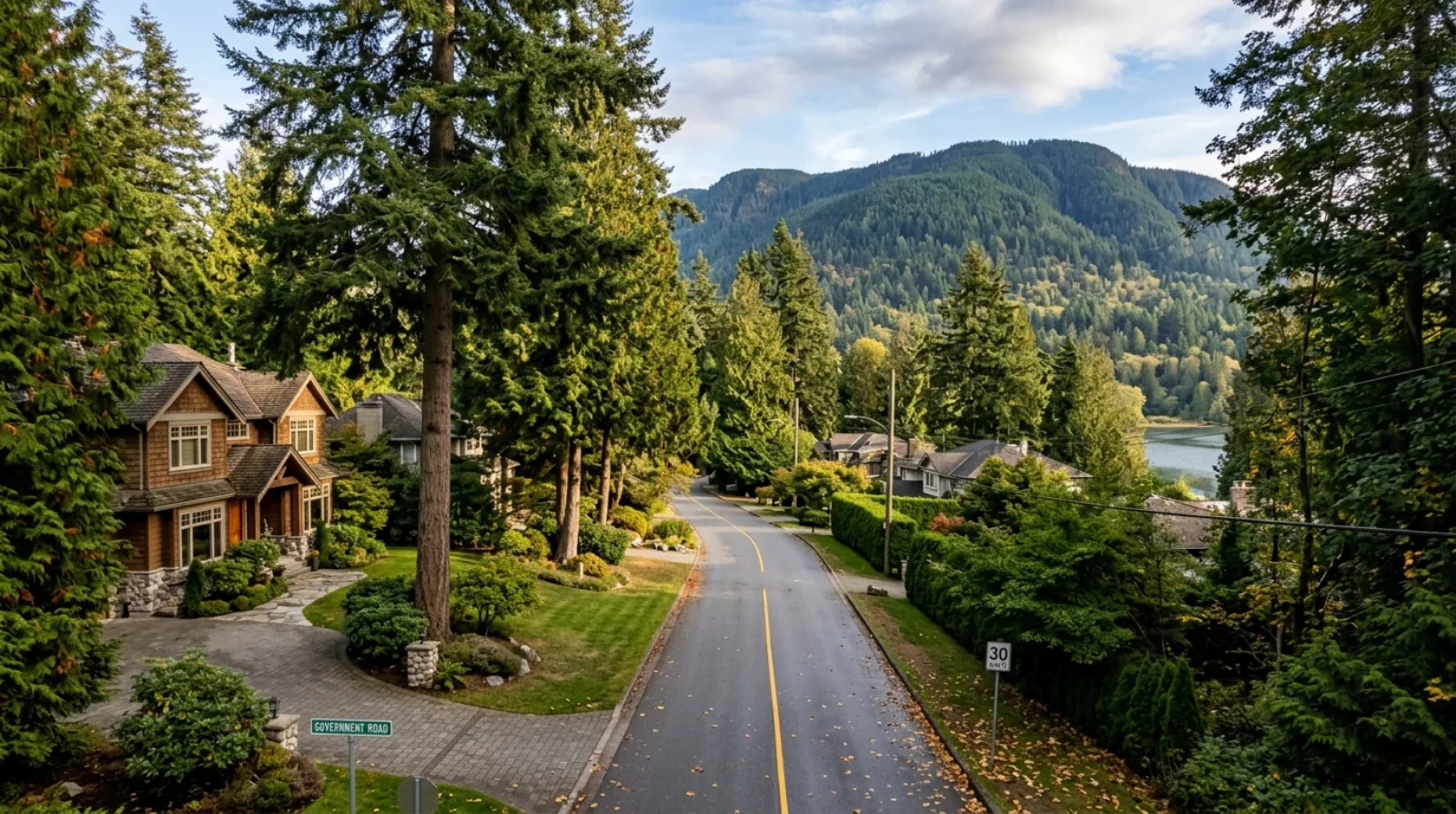
Government Road, to the west, is the opposite end of the spectrum, a quiet, large-lot estate enclave on the north shore of Burnaby Lake, with big single-family lots, mature trees, and a semi-rural feel. It has one SkyTrain station within reach (Sperling-Burnaby Lake) and limited walkable retail. It suits buyers who prioritise space, greenery, and quiet over walkability and density.

Sullivan Heights sits between the two, and that is its advantage. It offers a genuine mix of housing types, detached homes, townhomes, and condos, rather than committing to one. It has two SkyTrain stations (Lougheed Town Centre and Burquitlam) rather than one, giving it broader transit reach than Government Road. It has SFU close by up Burnaby Mountain, the Stoney Creek ravine, and a Coquitlam-border location with the North Road Korean restaurant and grocery corridor. For a family that wants both a real neighbourhood and strong transit and shopping access, Sullivan Heights hits a balance the other two do not.

(07)

What to Watch For When Buying in Sullivan Heights

The first thing to settle is which product and which part of the neighbourhood you are buying in. A detached home on a quiet RS street, a townhome, and a condo near Lougheed Town Centre are three different purchases with three different considerations. Be clear about what you actually want out of the neighbourhood, space and a yard, walkable convenience, or maximum transit access, because Sullivan Heights can deliver all three, but not usually in the same property.

For detached homes on the residential streets, read the lot carefully. If you are thinking about future potential under Bill 44, the specific lot dimensions, setbacks, and any proximity to the Stoney Creek ravine can affect what is buildable. Do not assume a detached lot here is a straightforward multiplex candidate. It depends on the parcel, and it needs a lot-by-lot read.

For townhomes and condos near the hub, strata health and building quality are central. Review the strata documents, depreciation report, contingency reserve, and any special levies carefully, and factor in how close the building is to the SkyTrain and the mall, proximity is a real value factor, but so is noise and traffic in the densest parts of the neighbourhood. A pre-purchase review with an agent who reads strata documents closely is the baseline.

Finally, confirm school access for your specific address. Stoney Creek Community School, Lyndhurst Elementary, and Cameron Elementary all serve the area at the K to 7 level, with Burnaby Mountain Secondary as the feeder secondary school, but catchment boundaries do change. Always confirm current catchment directly with the Burnaby School District (School District 41) before making a purchasing decision based on school access.

(08)

My Take as Your Advisor

Sullivan Heights is one of the northeast Burnaby areas I recommend most often to buyers who want balance. It gives families a real neighbourhood, schools, the Stoney Creek ravine, quiet residential streets, while keeping two SkyTrain stations, The City of Lougheed, and SFU all within easy reach. The buyers I tend to place here successfully are families who want space and school access without giving up transit and shopping, and first-time buyers or downsizers who want a townhome or condo with everything walkable.

The one thing I am always honest about is that Sullivan Heights is not a single market. The detached streets, the townhome pockets, and the condos near the mall are genuinely different products, and the right advice depends entirely on which one you are looking at. I will tell you plainly which part of the neighbourhood fits your goals, and if a different Burnaby area fits better, I will say so.

On pricing, I treat each property type on its own terms. A detached home is a land-and-lot question; a townhome is a layout-and-strata question; a condo is a floorplan-view-and-building question. Proximity to Lougheed Town Centre Station and Burquitlam Station is a real value factor across all three, and getting that read right matters whether you are buying at the right price or selling at the right number.

Sullivan Heights rewards buyers who know exactly what they want from the neighbourhood and who work with an advisor who can match the right product to those goals. I am happy to be that advisor, and to give you current market data for the specific property type you are considering rather than a neighbourhood average that hides more than it shows.

Getting Around

Commute times from Sullivan Heights.

SkyTrain figures are in-vehicle times from TransLink's official station-to-station chart; add a few minutes for transfers and waiting. Bus and nearest-station legs are noted per row. Driving times are approximate and off-peak.

DestinationBy TransitBy Car
Lougheed Town Centre Station (Expo + Millennium interchange)A major interchange, connections to the Expo Line toward New Westminster/Surrey and the Millennium Line toward Brentwood/downtown-direction transfers.Walkable or a short bus ride for much of the neighbourhood, the primary rapid-transit hub at The City of Lougheed.≈5 min off-peak
Burquitlam Station (Millennium Line)A second SkyTrain option, giving the neighbourhood dual-station access.A short trip toward the eastern side of the area, on the Evergreen Extension toward Port Moody and Coquitlam.≈5 to 10 min off-peak
SFU Burnaby CampusSFU sits at the summit of Burnaby Mountain, directly north of the neighbourhood.Up Burnaby Mountain to the north by bus toward the SFU campus.≈10 to 15 min off-peak up Burnaby Mountain
Brentwood Town CentreA direct Millennium Line connection from the interchange.Millennium Line westbound from Lougheed Town Centre Station.≈10 to 15 min off-peak
Downtown Vancouver (downtown-direction)Two SkyTrain lines from the interchange give more than one route toward downtown-direction transfers.Millennium Line to a downtown-direction transfer, or Expo Line via the Lougheed interchange.≈25 to 35 min off-peak via Highway 1 or Lougheed Highway
Coquitlam / Port Moody (Tri-Cities)The neighbourhood's eastern edge borders Coquitlam and Port Moody at North Road.Millennium Line eastbound (Evergreen Extension) from Burquitlam Station toward Port Moody and Coquitlam.≈10 to 20 min off-peak across the North Road / Coquitlam border
Side by Side

Sullivan Heights vs Lougheed vs Government Road: three northeast Burnaby options, three different priorities.

Sullivan HeightsLougheed (The City of Lougheed)Government Road
Location in BurnabyNortheast Burnaby (Coquitlam border)Northeast Burnaby (transit hub)North Burnaby (Burnaby Lake)
Housing characterMix, detached homes, townhomes, and condosMostly condominium towers and mixed-useLarge single-family lots, mature trees, semi-rural feel
SkyTrain accessTwo stations, Lougheed Town Centre + BurquitlamLougheed Town Centre (Expo + Millennium interchange)Sperling-Burnaby Lake (Millennium Line), car/bus for most
SFU proximityClose, short trip up Burnaby Mountain to the northClose, a short trip up the mountainClose via Gaglardi Way, ≈10 to 15 min drive
Shopping & diningThe City of Lougheed on the doorstep + North Road Korean corridorThe City of Lougheed, everything walkableLimited walkable retail; drive to Lougheed for daily needs
DensityMixed, quiet RS streets and higher density near the mallHigh, the densest of the threeLow, large-lot, low-density enclave
Primary appealBalance, real neighbourhood with dual-line transit and shoppingMaximum convenience and rapid transit at the doorSpace, greenery, and quiet on Burnaby Lake's north shore

SkyTrain and driving times are approximate off-peak figures. Housing and density comparisons are qualitative, not based on a verified current-date average, contact Jersey Li for current market data on a specific property type.

Multiplex Outlook

What multiplex means for this neighborhood.

Sullivan Heights has two distinct zoning stories. The standard residential streets fall under RS single-family zoning and are subject to BC's Bill 44 small-scale multi-unit housing legislation, which creates baseline multiplex rights (up to four or six units depending on lot characteristics) across most urban residential zones in the province. Actual feasibility on any given RS lot depends on individual lot dimensions, Burnaby's setback and lot-coverage rules, and any creek or ravine constraints near Stoney Creek. Separately, land close to Lougheed Town Centre sits in higher-density transit-oriented zoning (CD / RM and related designations), a genuinely different redevelopment picture, governed by a different framework and reflecting its position beside a major mall and an Expo Line / Millennium Line interchange. The first question on any Sullivan Heights property is which zoning story it belongs to. A lot-by-lot analysis, not a neighbourhood generalisation, is the right framework for any specific property, contact Jersey Li for a property-specific read.

Multiplex Advisory →
The Local Map

What's around you.

Sullivan Heights, approximate centre · map © OpenStreetMap contributorsView larger map ↗

Schools

  • Stoney Creek Community School , K to 7 public elementary, named for the salmon-bearing Stoney Creek that runs through the area; confirm current catchment with the Burnaby School District (School District 41)
  • Lyndhurst Elementary , K to 7 public elementary serving the area; confirm current catchment with the Burnaby School District (School District 41)
  • Cameron Elementary , K to 7 public elementary serving the area; confirm current catchment with the Burnaby School District (School District 41)
  • Burnaby Mountain Secondary School , The feeder secondary school for the area, grades 8 to 12; confirm current catchment with the Burnaby School District (School District 41)

Parks & Recreation

  • Stoney Creek & Ravine , A salmon-bearing creek and ravine that runs through the neighbourhood, a natural green corridor that gives Stoney Creek Community School its name
  • Burnaby Mountain Conservation Area , A large protected natural area up Burnaby Mountain to the north, accessible from the neighbourhood, forest trails and viewpoints
  • SFU Trails (Burnaby Mountain) , University and mountain trails accessible up Burnaby Mountain toward SFU to the north of the neighbourhood

Transit

  • Lougheed Town Centre Station (Expo + Millennium interchange) , A major SkyTrain interchange between the Expo Line and the Millennium Line, at The City of Lougheed, the neighbourhood's primary rapid-transit hub
  • Burquitlam Station (Millennium Line) , On the Evergreen Extension of the Millennium Line, toward Port Moody and Coquitlam, a second SkyTrain option serving the eastern side of the area
  • Millennium Line , Connects the neighbourhood to Coquitlam, Port Moody, Brentwood, and downtown-direction transfers
  • Expo Line (via Lougheed Town Centre Station) , Available at Lougheed Town Centre Station, southbound service toward New Westminster and Surrey via the interchange

Shopping & Dining

  • The City of Lougheed (Lougheed Town Centre) , The neighbourhood's main retail and dining hub, a major shopping centre with grocery, pharmacy, restaurants, cafes, and boutique eateries
  • North Road Korean corridor , A well-known Korean restaurant and grocery corridor along North Road on the Burnaby-Coquitlam border
Who Thrives Here

Who this neighborhood suits.

Frequently Asked

Questions buyers ask about Sullivan Heights.

What is the Sullivan Heights neighbourhood in Burnaby?

+

Sullivan Heights is a diverse, growing, family-friendly residential neighbourhood in northeast Burnaby. It sits north of Lougheed Highway, south of Simon Fraser University (SFU) on Burnaby Mountain, east of the Government Road area, and west of North Road, the road that divides Burnaby from Coquitlam. It borders Coquitlam and Port Moody, near the area colloquially called Burquitlam. Housing is a mix of older single-family detached homes on the residential streets, plus newer townhomes and condominiums near Lougheed Town Centre.

What school catchment is Sullivan Heights in?

+

Sullivan Heights is served by Stoney Creek Community School (K to 7), Lyndhurst Elementary (K to 7), and Cameron Elementary (K to 7), with Burnaby Mountain Secondary as the feeder secondary school (grades 8 to 12). All are part of the Burnaby School District (School District 41). School catchment boundaries do change, always confirm current catchment and enrollment eligibility directly with the Burnaby School District (School District 41) before making a purchasing decision based on school access.

What SkyTrain stations serve Sullivan Heights?

+

Two SkyTrain stations serve the area. Lougheed Town Centre Station is an interchange between the Expo Line and the Millennium Line, at The City of Lougheed. Burquitlam Station is on the Millennium Line (the Evergreen Extension) toward Port Moody and Coquitlam. The Millennium Line connects the neighbourhood to Coquitlam, Port Moody, Brentwood, and downtown-direction transfers. Having two stations gives Sullivan Heights broader transit reach than many Burnaby neighbourhoods, which typically have one.

What kinds of homes are available in Sullivan Heights?

+

Sullivan Heights has a genuine mix of housing types. On the quieter residential streets you find established single-family detached homes, many on standard RS lots. Closer to Lougheed Town Centre, newer townhouse and condominium development has added density. This range, detached, townhome, and condo, is one of the neighbourhood's defining features and suits first-time buyers, growing families, downsizers, and long-term owners alike. Each product is a different market with a different valuation approach, so contact Jersey Li for current market data on a specific property type.

What is there to do and where do people shop in Sullivan Heights?

+

The City of Lougheed (Lougheed Town Centre) is the neighbourhood's main retail and dining hub, with grocery, pharmacy, restaurants, cafes, and boutique eateries. Along North Road, on the Burnaby-Coquitlam border, there is a well-known Korean restaurant and grocery corridor. For nature, the Stoney Creek ravine runs through the area, and the Burnaby Mountain Conservation Area and SFU trails are accessible up the mountain to the north. Two SkyTrain stations connect residents to the wider region without a car.

How close is Sullivan Heights to SFU?

+

SFU (Simon Fraser University) sits at the summit of Burnaby Mountain, directly north of Sullivan Heights, and is a short trip up the mountain. The Burnaby Mountain Conservation Area and the SFU trails are accessible up the same slope. For SFU faculty, staff, and students, this proximity is a genuine practical advantage, the university is part of the geography immediately to the north of the neighbourhood.

Does Bill 44 apply to Sullivan Heights properties?

+

It depends on where in the neighbourhood the property is. The standard residential streets fall under RS single-family zoning, which is subject to BC's Bill 44 small-scale multi-unit housing legislation, baseline multiplex rights of up to four or six units depending on lot characteristics. Land close to Lougheed Town Centre is different: it sits in higher-density transit-oriented zoning, a genuinely different redevelopment picture. Actual feasibility on any RS lot depends on lot dimensions, Burnaby's setback and lot-coverage rules, and any creek or ravine constraints near Stoney Creek. Contact Jersey Li for a lot-by-lot analysis.

Is Sullivan Heights a good area for families?

+

Yes, Sullivan Heights is well suited to families who want a balance of space, schools, transit, and shopping. It has three K to 7 elementary options (Stoney Creek Community School, Lyndhurst Elementary, and Cameron Elementary), the Stoney Creek ravine as a natural green corridor, quiet residential streets with detached homes, and two SkyTrain stations plus The City of Lougheed on the doorstep. Confirm current catchment directly with the Burnaby School District (School District 41) before deciding based on school access.

How does Sullivan Heights compare to the Lougheed area?

+

Both are northeast Burnaby options centred near The City of Lougheed and Lougheed Town Centre Station, but they differ in density and housing type. The Lougheed area is the most urban of the two, dominated by condominium towers and mixed-use development right at the Expo Line / Millennium Line interchange, with everything walkable. Sullivan Heights offers a broader mix of housing (detached homes, townhomes, and condos), a second SkyTrain station at Burquitlam, the Stoney Creek ravine, and a more family-neighbourhood feel. Sullivan Heights suits buyers who want a real neighbourhood with strong transit and shopping access, rather than a purely high-density setting.

How does Sullivan Heights compare to Government Road?

+

They are very different neighbourhoods. Government Road, to the west, is a quiet large-lot estate enclave on the north shore of Burnaby Lake, big single-family lots, mature trees, a semi-rural feel, one SkyTrain station within reach, and limited walkable retail. Sullivan Heights is more connected and more varied: a mix of detached homes, townhomes, and condos, two SkyTrain stations, The City of Lougheed and the North Road Korean corridor on the doorstep, SFU close by, and a Coquitlam-border location. Government Road suits buyers who prioritise space and quiet; Sullivan Heights suits those who want a family neighbourhood with strong transit and shopping access.

Keep Exploring

Other Burnaby neighborhoods.

Free · No Obligation

What's your Sullivan Heights home worth today?

Get a data-driven valuation from a local Burnaby expert, not an automated guess.

Considering Sullivan Heights?

Let's talk about your Sullivan Heights move.

Whether you're buying, selling, or weighing a multiplex play, I'll give you the straight read. No pressure, no obligation.

Book a Consultation
CallFree Valuation