Skip to content
JERSEY LIPERSONAL REAL ESTATE CORPORATION
Big Bend / South Burnaby

Big Bend, honestly: Fraser River, farmland, and smart buys.

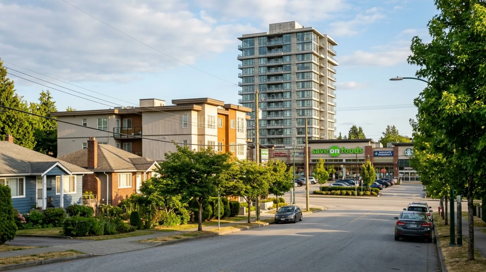
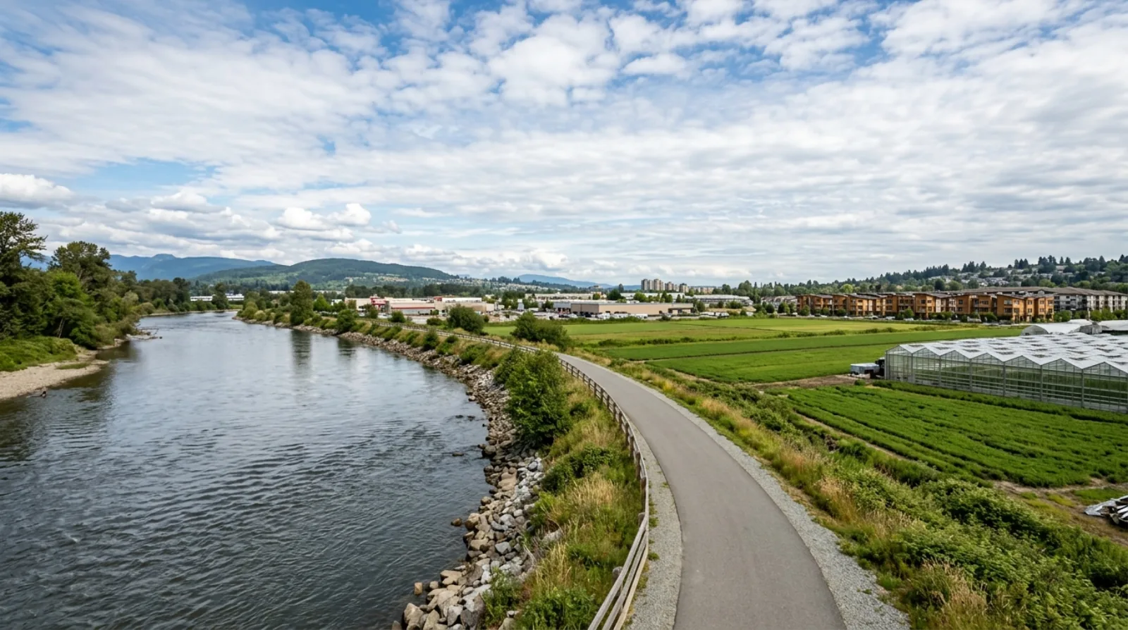
Big Bend is Burnaby's southernmost and largest neighbourhood by area, and it is unlike anywhere else in Metro Vancouver. Flat land stretches from the bend of the Fraser River's North Arm northward to Marine Drive, carrying a mix that surprises most buyers: productive farmland under Agricultural Land Reserve protection, movie studios and light industrial parks, the big-box retail cluster of Marine Way Market and Big Bend Crossing, and a small set of residential pockets — including established townhome communities just off Marine Drive and the hillside single-family streets of South Slope rising above it all. The Fraser Foreshore Park runs for four kilometres along the river, giving residents a genuine waterfront trail that feels nothing like the urban density a few kilometres north. If you are looking for a quiet, lower-density corner of Burnaby with direct river access, an honest price point, and proximity to South Slope's family neighbourhoods, Big Bend is worth understanding before you dismiss it.

Jersey LiSutton Group — 1st West RealtyMedallion ClubUpdated
Big Bend, Burnaby
HousingTownhomes, single-family (South Slope above Marine Drive), limited supply
MultiplexLimited — ALR, industrial, and mixed uses dominate the flat lands; South Slope single-family lots eligible under Bill 44
Quick Answer

Big Bend is Burnaby's southernmost neighbourhood, a low-lying area along the bend of the Fraser River below Marine Way. It is thinly populated and mixes Agricultural Land Reserve farmland, light industrial and film-studio land, major big-box retail on Marine Way (Marine Way Market and Big Bend Crossing), and a small number of residential pockets including townhome developments near Marine Drive and the hillside single-family streets of South Slope above. The Fraser Foreshore Park offers a four-kilometre riverside trail. Transit is bus-dependent; the nearest SkyTrain stations are Edmonds and Royal Oak on the Expo Line, each requiring a bus connection.

Key Takeaways
  • 01Big Bend is Burnaby's southernmost neighbourhood, bounded by Marine Drive (north), Boundary Road (west), Fenwick Street (east), and the Fraser River (south).
  • 02The flat land south of Marine Way is primarily ALR farmland, light industrial, movie studio lots, and two large retail centres — it is thinly populated with very limited residential supply.
  • 03Residential options concentrate just off Marine Drive (established townhome communities such as New Haven Close and McGregor by Amacon) and on South Slope (single-family streets on the hillside above Marine Drive).
  • 04Marine Way Market (274,000 sq ft, anchored by Save-On-Foods, Canadian Tire, and London Drugs) and Big Bend Crossing (182,000 sq ft, with Winners/HomeSense, PetSmart, Staples, and Michaels) provide substantial retail on the doorstep.
  • 05Burnaby Fraser Foreshore Park runs four kilometres along the Fraser River with a paved multi-use trail, fitness stations, volleyball courts, playground, and off-leash dog zone.
  • 06Riverway Golf Course at 9001 Bill Fox Way is an 18-hole championship public course with a night-lit driving range, open year-round.
Your Big Bend Agent

Your Big Bend real estate agent — Jersey Li.

Big Bend is a neighbourhood most buyers overlook because they hear 'farmland and industrial' and stop reading. That is exactly why it rewards a buyer who takes the time to understand it. The residential pockets here — the townhome communities tucked just off Marine Drive and the single-family streets climbing South Slope — offer more space and lower noise than equivalent product in Metrotown or Brentwood, and they sit beside one of the best riverside parks in Metro Vancouver. My job is to show you what is actually available here, not just what the listing photos choose to show.

For buyers looking at South Slope single-family homes with river views and hillside character, I understand how the market here compares to Suncrest and the broader South Burnaby pocket. These streets see fewer competing offers than the north Burnaby corridors, and the Bill 44 multiplex rules apply to standard RS-zoned lots on South Slope — meaning a buyer who plans ahead can add legal suites or small-scale multi-unit development to a purchase that already makes sense to live in.

I also work closely with buyers who need an honest read on the ALR and industrial land context in the flat parts of Big Bend. This matters both for buyers of the townhome communities near Marine Drive (so you understand what surrounds your development) and for any buyer considering land that borders agricultural or industrial parcels. I give you the straight picture, including the constraints, before you make an offer — not after.

  • South Burnaby market knowledge covering Big Bend, South Slope, Suncrest, and the Marine Way corridor
  • Bill 44 multiplex advisory for South Slope RS-zoned lots — suites, laneway, and small-scale multi-unit eligibility
  • Fluent service in English, Mandarin, and Cantonese for South Burnaby's diverse buyer base
  • Medallion Club agent (top 10% REBGV) — Sutton Group — 1st West Realty
Jersey LiSutton Group — 1st West RealtyMedallion ClubLicensed (RECBC)
Work with Jersey in Big Bend
On This Page
(01)

The Big Bend Character

Big Bend takes its name from the large bend in the Fraser River's North Arm that defines the neighbourhood's southern edge. The area is flat, low-lying, and large — it is the biggest neighbourhood in Burnaby by land area, yet one of the most thinly populated. This is not a planning failure; it is the direct result of ALR protection and industrial zoning that have kept dense residential development off the land for decades.

The neighbourhood divides roughly into three layers. The land south of Marine Way — closest to the Fraser River — is primarily ALR farmland, community gardens, light industrial parks, movie and television studio lots, and the two large retail centres at Marine Way and Byrne Road. Marine Way itself is the functional spine, a fast arterial that connects east to New Westminster and the Queensborough Bridge and west toward South Vancouver. North of Marine Way, the land rises to become South Slope, a residential hillside of single-family homes and older ranchers with direct views south over the farms and the river.

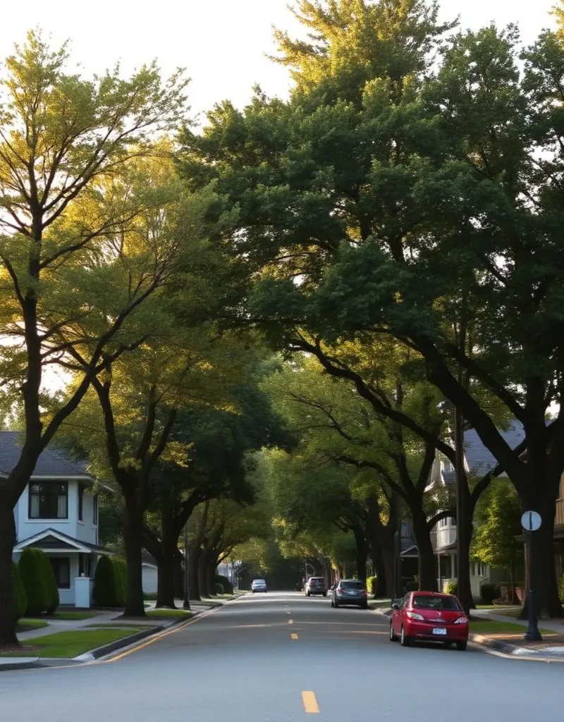
The residential communities that do exist here have a quiet, almost rural feel compared to the rest of Burnaby. Streets near Willard and Meadow avenues carry echoes of an agricultural history dating to 1861, when Chinese-Canadian market gardeners drained the natural cranberry marshes and created some of the richest soils on the Burrard Peninsula. Several small farms and community garden plots still operate, which is rare for a neighbourhood this close to a major urban centre.

What you will not find in Big Bend is the density, transit frequency, or commercial vibrancy of Brentwood or Metrotown. This is a deliberate trade: less congestion, more open space, a genuine working river on your doorstep, and a pace of life that is closer to suburban than urban.
(02)

Housing in Big Bend

Residential supply in Big Bend is genuinely limited, which is the first thing a buyer needs to understand. The majority of the neighbourhood's land area is either ALR farmland, industrial zoning, or commercial retail — none of which allows residential development. What housing does exist concentrates in two distinct pockets.

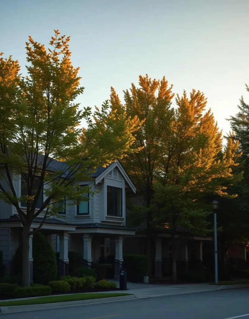
The flat lands just off Marine Drive contain a small number of established townhome communities. New Haven Close, built on the former grounds of the historic New Haven Borstal Home for Boys, is one example — a development of townhomes set in a quiet, landscaped setting near the Marine Drive and Byrne Road intersection. McGregor by Amacon is another, a twelve-acre park-like development with corner townhomes backing onto greenbelts. These communities offer more private, ground-oriented living than condo towers, but they come up infrequently and sell quickly when they do.

South Slope, the hillside above Marine Drive, is the larger residential area. Its streets contain a mix of single-family homes ranging from post-war ranchers to newer custom builds, with south-facing lots offering views across the farms and the Fraser River toward Surrey and Delta. South Slope is technically a separate neighbourhood from Big Bend in City of Burnaby planning documents, but buyers shopping the Marine Drive corridor tend to compare both areas side by side.

Detached lots are rare in the flat Big Bend area itself. When they appear, they often carry complex zoning or ALR adjacency considerations that require careful due diligence. Buyers looking for land-based opportunity in this part of Burnaby should approach with legal advice on ALR constraints before making an offer.

(03)

Retail: Marine Way Market and Big Bend Crossing

Despite its low residential density, Big Bend has serious retail infrastructure on Marine Way. Two large shopping centres sit within a short drive of each other, giving residents access to a full range of everyday and specialty retail without leaving the area.

Marine Way Market (also known as Market Crossing) is a 274,000-square-foot Class A retail centre on twenty acres at Marine Way and Byrne Road. It is triple-anchored by Save-On-Foods, Canadian Tire, and London Drugs, and counts more than forty retailers including Cactus Club, Mark's Work Warehouse, BC Liquor Store, White Spot, Starbucks, Tim Horton's, and McDonald's. This is a full-service grocery-and-lifestyle centre that handles almost all household errands without requiring a trip to Metrotown.

Big Bend Crossing, at 5751–5821 Marine Way, is a 182,000-square-foot centre anchored by Winners/HomeSense, PetSmart, Staples, Michaels, and Dollarama, with Boston Pizza, Nando's, and Sungiven Foods for dining and food shopping. Together the two centres cover a wide range of retail — it is one of the better-served big-box corridors in South Burnaby.

The honest note is that this retail is car- or bus-oriented. It is not walkable from most residential addresses in the neighbourhood without a meaningful journey on foot. Residents in the townhome communities near Marine Drive can walk to the centres in ten to fifteen minutes; residents on South Slope streets will typically drive or take the bus.

(04)

Parks and Outdoor Life

The Fraser Foreshore Park is the neighbourhood's defining asset. Running four kilometres along the north bank of the Fraser River from Boundary Road east to Fraser Park Drive, this is a genuine linear waterfront park with a paved, wheelchair-accessible multi-use path, twelve outdoor fitness stations, two beach volleyball courts, a children's playground with a pirate-ship feature, off-leash dog zone, and picnic areas. You can watch tugboats, barges, and log booms on the working river from the dike path — it is a rare view in the Lower Mainland, and it is completely free. The park runs from dawn until dusk year-round; the main parking lot is at the foot of Byrne Road via Fraser Park Drive.

Byrne Creek Ravine Park, just off Marine Drive, offers a contrasting experience: a 3.2-kilometre forested loop trail through mature second-growth Douglas fir, western red cedar, and bigleaf maple, following a salmon-bearing creek through a natural ravine. The trail connects to Ron McLean Park at the top, which has tennis courts, a playground, basketball courts, and a soccer field. Combined, they give Big Bend residents a green corridor from the river flats up into the residential streets above — one of the better urban nature walks in South Burnaby.

Riverway Golf Course, at 9001 Bill Fox Way, is a city-operated 18-hole championship course of 7,004 yards, par 72, opened in 1994. It features links-style fairways, a 54-stall covered and climate-controlled driving range open until midnight, a pro shop, and a clubhouse restaurant. This is one of the most accessible public golf facilities in the Lower Mainland, and it sits directly inside the neighbourhood.

(05)

Understanding the ALR and Industrial Land

Big Bend contains the only true farmland remaining on the Burrard Peninsula. Approximately 620 acres of land in the neighbourhood were placed in the Agricultural Land Reserve in the 1970s, protecting them from residential subdivision. Several small to medium-sized farms and around six hectares of community gardens on Meadow Avenue and Willard Street remain active today. The average gross farm receipts per farm in the area have historically been among the highest in BC, reflecting the quality of the reclaimed river-delta soils.

For buyers, the practical implication is clear: this land will not be rezoned for residential development in any foreseeable planning cycle. The ALR functions as a permanent green buffer south of Marine Way, which is actually a significant quality-of-life asset for residents of the townhome communities nearby — it means no future tower construction immediately adjacent to your home.

The industrial and film-studio land interspersed with the farms is a different consideration. Active production facilities and light industrial operations mean occasional truck traffic and commercial activity on weekdays. Buyers considering townhomes or the rare detached property near these parcels should tour the surroundings on a Tuesday morning, not a Sunday afternoon, to get an accurate picture of the noise and activity level.

(06)

Big Bend vs South Slope vs Suncrest

Buyers in this part of South Burnaby often compare Big Bend, South Slope, and Suncrest side by side. The three areas are adjacent and share a postal boundary, but they serve different buyer profiles.

Big Bend (the flat area south of Marine Drive) is best suited to buyers specifically seeking the townhome communities near Marine Way, or the occasional detached property with large lot sizes and a rural character. Supply is thin and turnover is slow — when a townhome at New Haven Close or McGregor comes to market, serious buyers move fast. The ALR surroundings and proximity to industrial land mean the area is not for everyone, but buyers who appreciate the river park, the golf course, and the open-sky feeling tend to stay for many years.

South Slope (the hillside above Marine Drive) is a conventional single-family residential neighbourhood with a mature tree canopy, south-facing views, and a family-oriented feel. It is closer to Suncrest in character than to the flat Big Bend area. Lots here are standard urban-residential sizes and are eligible for Bill 44 multiplex redevelopment under RS zoning, which adds a layer of future land value to well-located parcels.

Suncrest, just to the north, is the most densely residential of the three, with more townhouse strata complexes, older post-war housing, and proximity to Burnaby South Secondary. Suncrest tends to have more turnover and a wider range of price points than the thinly traded Big Bend flat lands.

(07)

What to Watch For When Buying in Big Bend

Low supply is the defining feature of the buyer's experience here. If you are targeting a specific townhome community like New Haven Close or McGregor, accept that you may need to wait for a unit to come to market rather than having a menu of options. Ask your agent to check strata sale restrictions and whether the corporation allows long-term rentals — both affect your future flexibility.

ALR boundary awareness matters. Check the city's zoning maps before any offer to confirm whether the property or its immediate neighbours are within the ALR. Properties adjacent to ALR land have excellent long-term protection from over-development, but they can also carry drainage and setback considerations that affect what you can build or modify on-site.

Due diligence on industrial adjacency is not optional. Some Big Bend residential properties sit close to light industrial or film-studio parcels. Review the city's noise and use permits for neighbouring parcels; what operates quietly today can change under new tenants. A simple search of Burnaby's development tracker will show active and pending industrial applications near any address.

Transit access is honest but not frequent. There is no SkyTrain station in or immediately adjacent to Big Bend. Bus routes 100 and 116 serve the Marine Way corridor, connecting to Edmonds and 22nd Street stations on the Expo Line. Plan for a bus-plus-SkyTrain commute of roughly thirty to forty-five minutes to downtown Vancouver depending on timing. If you depend on transit, test the route during your actual commute hours before finalizing your decision.

(08)

My Take as Your Advisor

Big Bend rewards buyers who take a wide view of what a neighbourhood can be. Most people searching for South Burnaby real estate focus on Metrotown, Edmonds, or South Slope and never investigate the flat Big Bend pocket below Marine Drive. That relative lack of competition is a practical advantage: when a well-maintained townhome comes to market in one of the established communities here, it is often competing with fewer offers than comparable product in the busier corridors.

The buyers I tend to place well in Big Bend are people who want ground-oriented living — a front door that opens to the ground, a small private yard or patio — and who value the Fraser Foreshore Park and Riverway Golf Course as genuine daily amenities rather than as nice-sounding marketing. For that buyer, the industrial and agricultural context is a fair trade-off, and often a quiet one in practice.

The buyers I steer elsewhere are those who need frequent, reliable transit to downtown Vancouver, who want walkable dining and cafes on their doorstep, or who expect their neighbourhood to feel like a conventional residential grid. Big Bend is not that, and there is no point pretending otherwise. The honest match is a buyer who wants space, nature, and a slower pace within city limits — and who does not need SkyTrain at the end of their block.

Getting Around

Commute times from Big Bend.

SkyTrain figures are in-vehicle times from TransLink's official station-to-station chart; add a few minutes for transfers and waiting. Bus and nearest-station legs are noted per row. Driving times are approximate and off-peak.

DestinationBy TransitBy Car
Metrotown (Burnaby's retail and transit hub)The drive is straightforward; transit requires a bus-to-SkyTrain transfer.≈25–35 min — bus 116 to Edmonds Station, then 2 stops on the Expo Line to Metrotown; or bus 100 connecting via 22nd Street Station.≈10–15 min off-peak via Marine Way and Kingsway
Downtown Vancouver (Waterfront)≈40–50 min — bus to Edmonds or 22nd Street Station, then Expo Line into downtown; add transfer and wait time.≈25–35 min off-peak via Marine Way west toward South Vancouver and the bridge crossings
New Westminster (downtown)≈20–30 min — bus 100 east along Marine Way to 22nd Street Station; New Westminster is one stop from there.≈10–15 min via Marine Way east across the Queensborough Bridge approach
Edmonds Station (Expo Line)Edmonds gives direct Expo Line access to Metrotown, New Westminster, and downtown Vancouver.≈15–20 min by bus 116 from the Marine Way corridor; Edmonds is the primary SkyTrain connection for most Big Bend addresses.≈5–10 min off-peak
Surrey (King George Station area)≈35–45 min — bus to Edmonds or 22nd Street Station, then Expo Line across the Pattullo Bridge corridor.≈20–25 min via Marine Way and the Queensborough/Pattullo routes off-peak
YVR / Vancouver AirportApproximately 60–75 min via bus to Edmonds Station, Expo Line to Columbia, transfer to Canada Line.≈25–35 min off-peak via Marine Way west and the Arthur Laing Bridge approach
Side by Side

Big Bend vs South Slope vs Suncrest — three adjacent areas in south Burnaby with different characters.

Big Bend (flat area)South SlopeSuncrest
Primary land useALR farmland, industrial, film studios, big-box retail, small townhome pocketsSingle-family residential hillside with river viewsResidential mix of single-family homes and older townhomes
Residential supplyVery limited — a few established townhome communities; rare detachedModerate — standard single-family grid on hillside streetsWider — more turnover, post-war houses, and strata townhome complexes
Nearest SkyTrainBus to Edmonds or 22nd Street Station (Expo Line)Bus to Royal Oak or Edmonds (Expo Line)Bus to Royal Oak Station (Expo Line)
Parks and natureFraser Foreshore Park (4 km riverside trail), Riverway Golf Course, Byrne Creek RavineViews over Fraser River and farms; connects to Byrne Creek aboveNeighbourhood parks; Deer Lake Park a short drive north
Bill 44 multiplex potentialVery limited — most land is ALR or industrial, not RS residentialEligible on standard RS lots — suite, laneway, or multi-unit options availableEligible on RS lots; strata properties excluded
Best fit buyerBuyers wanting ground-oriented townhome or rural-feel detached, car-based commuters, golfersFamilies wanting single-family with views, South Burnaby school catchment, Bill 44 upsideFirst-time buyers, investors, those needing a wider range of available price points

Transit times are approximate and bus-dependent; no SkyTrain station sits within walking distance of the Big Bend flat area. ALR boundaries should be verified against City of Burnaby zoning maps before any purchase.

Multiplex Outlook

What multiplex means for this neighborhood.

The flat land south of Marine Drive in Big Bend is largely outside the scope of Bill 44 multiplex strategy. ALR protection, industrial zoning, and limited residential inventory mean that most parcels here are not eligible for small-scale multi-unit redevelopment. The exception is the South Slope hillside above Marine Drive, where standard RS-zoned single-family lots are eligible under Bill 44 for up to four to six units depending on lot size and proximity to transit. Buyers interested in multiplex potential should focus on South Slope addresses and confirm RS zoning before purchase, as some lots on the slope may carry overlay designations that affect what Bill 44 allows. I run specific eligibility checks for every South Burnaby buyer who is considering this path.

Multiplex Advisory →
The Local Map

What's around you.

Big Bend — approximate centre · map © OpenStreetMap contributorsView larger map ↗

Schools

  • Glenwood Elementary School — K–7 public school on Marine Drive, the primary elementary in the Big Bend flat area; School District 41 (Burnaby)
  • Suncrest Elementary School — K–7 public school on Rumble Street serving the South Slope and Suncrest catchment just above Big Bend
  • South Slope Elementary / BC School for the Deaf — Combined site serving the upper South Slope catchment; also provides specialized programming for Deaf students province-wide
  • Burnaby South Secondary — Grades 8–12 public secondary; serves the South Slope, Suncrest, and Big Bend area; established academic and arts programming
  • Byrne Creek Secondary — Grades 8–12 public secondary; an alternative secondary option for parts of south and southwest Burnaby

Parks & Recreation

  • Burnaby Fraser Foreshore Park — 4-km paved riverside trail, outdoor fitness circuit, volleyball courts, playground, off-leash dog zone, picnic areas along the Fraser River North Arm
  • Riverway Golf Course — City-operated 18-hole championship course, 7,004 yards par 72, 54-stall night-lit driving range; 9001 Bill Fox Way
  • Byrne Creek Ravine Park — 3.2-km forested loop trail through mature second-growth fir and cedar; connects to Ron McLean Park with tennis, playground, and sports fields
  • Ron McLean Park — Upper connector to Byrne Creek trail; tennis courts, basketball court, playground, soccer/baseball field
  • Meadow Avenue Community Gardens — Nearly six hectares of community garden plots on reclaimed river-delta farmland — one of Burnaby's largest community growing spaces

Transit

  • Bus 100 (Marine/22nd St Station) — Primary bus serving Marine Way — connects Big Bend retail corridor west toward 22nd Street Station (Expo Line, New Westminster)
  • Bus 116 (Marine Drive/Edmonds Station) — Connects Marine Way corridor north to Edmonds Station on the Expo Line; Edmonds is approximately 2.5 km from the Big Bend retail hub
  • Edmonds Station (Expo Line) — Nearest SkyTrain station for most Big Bend addresses — direct Expo Line service toward Metrotown (2 stops), New Westminster, and downtown Vancouver
  • 22nd Street Station (Expo Line) — Alternate SkyTrain access at the eastern edge of the neighbourhood; serves New Westminster and onward connections
  • Royal Oak Station (Expo Line) — A further option at the northern edge of South Slope — approximately 2.5 km from Big Bend Crossing; useful for South Slope residents closer to Royal Oak Avenue
  • Queensborough Bridge / Marine Way — Direct road connection to Queensborough and the Fraser Valley; useful for drivers commuting east or south

Shopping & Dining

  • Marine Way Market (Market Crossing) — 274,000 sq ft across 20 acres; anchored by Save-On-Foods, Canadian Tire, and London Drugs; also Cactus Club, White Spot, BC Liquor Store, Starbucks, and 40+ retailers; 7200 Market Crossing
  • Big Bend Crossing — 182,000 sq ft centre at 5751 Marine Way; Winners/HomeSense, PetSmart, Staples, Michaels, Dollarama, Sungiven Foods, Boston Pizza, Nando's
  • Save-On-Foods (Marine Way Market) — Full-service grocery anchor at Marine Way Market — the primary supermarket serving Big Bend and South Slope
  • Metrotown (Burnaby's major retail hub) — 10–15 min drive or bus+SkyTrain for specialty retail, IKEA, Whole Foods, and BC's largest mall — Metropolis at Metrotown
  • New Westminster Quay Market — Accessible via Marine Way east across the Queensborough area; farmers market and specialty food shops on the Fraser River
Who Thrives Here

Who this neighborhood suits.

Frequently Asked

Questions buyers ask about Big Bend.

What kind of homes are for sale in Big Bend, Burnaby?

+

Residential supply in Big Bend is limited. The majority of the neighbourhood's land is Agricultural Land Reserve farmland, industrial zoning, or commercial retail — none of which allows residential development. What housing exists concentrates in a small number of established townhome communities near Marine Drive (such as New Haven Close and McGregor by Amacon) and the occasional detached property with large lots. The hillside single-family neighbourhood of South Slope sits directly above Big Bend along Marine Drive and is often compared alongside it by buyers.

Is Big Bend a good place to live?

+

Big Bend suits a specific type of buyer well. If you want ground-oriented living (a private entrance and a small yard), easy access to a four-kilometre riverside trail and a public golf course, and you commute by car rather than SkyTrain, Big Bend delivers genuine quality of life at a lower noise and congestion level than Burnaby's denser corridors. If you depend on frequent rapid transit, want walkable cafes and restaurants, or want a conventional residential neighbourhood feel, this is not the right fit — and it is worth being honest about that before you view.

How is the commute from Big Bend?

+

Transit commutes from Big Bend require a bus connection before you reach SkyTrain. Bus routes 100 and 116 serve the Marine Way corridor and connect to Edmonds Station and 22nd Street Station on the Expo Line. From Edmonds, downtown Vancouver is roughly 20–25 minutes in-vehicle on the Expo Line. Total door-to-door time to downtown Vancouver is typically 40–50 minutes depending on timing. By car, Marine Way gives fast access east toward New Westminster and the Fraser Valley; the drive to downtown Vancouver is 25–35 minutes off-peak.

What shopping is available in Big Bend?

+

Big Bend has more retail than most people expect for a thinly populated neighbourhood. Marine Way Market (also called Market Crossing) at Marine Way and Byrne Road is a 274,000-square-foot centre anchored by Save-On-Foods, Canadian Tire, and London Drugs, with more than forty retailers including Cactus Club, White Spot, BC Liquor Store, and Starbucks. Big Bend Crossing, a short distance west on Marine Way, adds Winners/HomeSense, PetSmart, Staples, Michaels, and Dollarama. For specialty retail, Metrotown is about ten to fifteen minutes away by car.

What parks are in Big Bend, Burnaby?

+

Burnaby Fraser Foreshore Park is the area's signature park: a four-kilometre paved trail along the north bank of the Fraser River, with outdoor fitness stations, two volleyball courts, a children's playground, off-leash dog zone, and picnic areas. Byrne Creek Ravine Park runs from Marine Drive upward through a forested ravine and connects to Ron McLean Park (tennis, basketball, soccer). Riverway Golf Course at 9001 Bill Fox Way is a city-operated 18-hole championship public course with a night-lit driving range.

Are there farms in Big Bend, Burnaby?

+

Yes. Big Bend contains the only productive farmland remaining on the Burrard Peninsula. Approximately 620 acres were placed in the Agricultural Land Reserve in the 1970s and remain protected. Several small to medium-sized farms and around six hectares of community gardens operate on Willard Street and Meadow Avenue today. This ALR land cannot be rezoned for residential or commercial development, which is both a constraint and a long-term asset for nearby residents.

What schools serve Big Bend, Burnaby?

+

Glenwood Elementary School on Marine Drive is the primary public elementary school for the Big Bend flat area. The South Slope and Suncrest catchment is served by Suncrest Elementary on Rumble Street and South Slope Elementary. Burnaby South Secondary serves the area for grades 8–12, with Byrne Creek Secondary as an alternative option. All schools are part of Burnaby School District 41. For precise catchment confirmation, use the district's school locator tool with the specific address.

Can I build a multiplex or secondary suite in Big Bend?

+

It depends significantly on where in Big Bend you are looking. The flat area south of Marine Drive is mostly ALR farmland or industrially zoned land — Bill 44 multiplex rules do not apply to those parcels. Townhome strata properties also sit outside Bill 44 scope. However, RS-zoned single-family lots on South Slope (the hillside above Marine Drive) are eligible for Bill 44 multi-unit redevelopment — up to four or six units depending on lot size and proximity to transit. I run specific eligibility checks for every South Burnaby buyer considering this.

How does Big Bend compare to Suncrest and South Slope?

+

The three areas are adjacent but serve different buyers. Big Bend (the flat area) has the least residential supply, the most distinctive natural assets (Fraser Foreshore, Riverway), and the most car-dependent lifestyle — suitable for buyers who value space and nature over walkability. South Slope is a conventional hillside single-family neighbourhood with views and Bill 44 potential — good for families staying for the medium to long term. Suncrest is the most actively traded of the three, with a wider price range, more townhome strata stock, and slightly better bus access to Royal Oak Station.

Why is Big Bend so thinly populated?

+

The low population is intentional and structural. The City of Burnaby's Big Bend Development Plan, adopted in the 1970s, placed approximately 620 acres of the flat lands in the Agricultural Land Reserve, protecting them from residential subdivision. The remaining land south of Marine Way was designated for industrial and commercial use, which became the Marine Way corridor of retail and film studios you see today. The result is a neighbourhood where most of the land cannot legally become residential — and has not changed materially in forty years.

Keep Exploring

Other Burnaby neighborhoods.

Free · No Obligation

What's your Big Bend home worth today?

Get a data-driven valuation from a local Burnaby expert — not an automated guess.

Considering Big Bend?

Let's talk about your Big Bend move.

Whether you're buying, selling, or weighing a multiplex play, I'll give you the straight read. No pressure, no obligation.

Book a Consultation
CallFree Valuation