Skip to content
JERSEY LIPERSONAL REAL ESTATE CORPORATION
Burnaby Lake / Central Burnaby

Burnaby Lake, the green heart at the centre of Burnaby.

Burnaby Lake sits at the geographic centre of the city, on the low-density residential land that wraps around Burnaby Lake and the Burnaby Lake Regional Park. In real-estate listings (MLS/REW), "Burnaby Lake" is used as an area name for the quiet, green residential pockets near the lake and the sports complex, a mix of established detached single-family homes, older townhouses, and some low-rise condominiums on tree-lined streets. What defines this area is not a dense residential core; it is the lake itself and the recreation that surrounds it. The Burnaby Lake Regional Park is a genuine wildlife reserve of more than 300 hectares, and the Burnaby Lake Sports Complex on Kensington Avenue is one of the city's main sports hubs. The Millennium Line's Sperling-Burnaby Lake Station (Sperling Avenue and Lougheed Highway) sits on the northwest side, and Lake City Way Station is to the northeast, but most residents on the quiet streets drive for daily errands. Burnaby Lake appeals to nature-loving families and buyers who want a quieter, greener setting while staying central in Burnaby. The estate-lot streets on the north shore are covered by the Government Road area, Deer Lake Park is a separate landscaped cultural park to the southwest, and the Cariboo and Montecito hillside streets sit to the east and southeast, Burnaby Lake is the shared green heart these neighbours wrap around.

Jersey LiSutton Group - 1st West RealtyMedallion ClubUpdated
Burnaby Lake, Burnaby
HousingA mix of established detached single-family homes, older townhouses, and some low-rise condominiums
MultiplexRS residential streets, Bill 44 applies; much nearby land is park or institutional, so redevelopment is pocket-by-pocket
Quick Answer

Burnaby Lake is a quiet, green, low-density residential area at the geographic centre of Burnaby, on the land that wraps around Burnaby Lake and the Burnaby Lake Regional Park. It is defined by recreation and nature rather than a dense residential core, the regional park is a genuine wildlife reserve of more than 300 hectares, and the Burnaby Lake Sports Complex on Kensington Avenue is a major sports hub. Housing is a mix of established detached homes, older townhouses, and some low-rise condominiums on tree-lined streets. Sperling-Burnaby Lake Station and Lake City Way Station (both Millennium Line) are the nearest SkyTrain links, but most residents on the low-density streets drive for daily errands. Contact Jersey Li for current market data.

Key Takeaways
  • 01Burnaby Lake is a quiet, green, low-density residential area at the geographic centre of Burnaby, on the land wrapping around Burnaby Lake and the Burnaby Lake Regional Park.
  • 02The area's identity is built on recreation and nature, the regional park and the Burnaby Lake Sports Complex, rather than on a specific dense residential core.
  • 03Burnaby Lake Regional Park is a Metro Vancouver nature reserve of more than 300 hectares, with a trail network circling the lake, birdwatching, canoeing and kayaking, the Piper Spit pier, and the Burnaby Lake Nature House.
  • 04The Burnaby Lake Sports Complex on Kensington Avenue splits into West and East facilities, with artificial-turf fields for soccer, field hockey, field lacrosse, football, rugby, cricket, and ultimate; the Bill Copeland Sports Centre ice arena and a rowing/paddling pavilion are part of the lakeside facilities.
  • 05Sperling-Burnaby Lake Station (northwest) and Lake City Way Station (northeast) on the Millennium Line are the nearest SkyTrain links, but most residents on the low-density streets drive for daily errands.
  • 06Housing is a mix of established detached single-family homes, older townhouses, and some low-rise condominiums; much of the surrounding land is park or institutional, so residential redevelopment happens pocket by pocket.
Your Burnaby Lake Agent

Your Burnaby Lake real estate agent, Jersey Li.

Burnaby Lake is one of the harder Burnaby areas to read well, because "Burnaby Lake" on a listing can mean several different things. The green premium of a home that genuinely backs onto or looks toward park land is real and specific. It is a different value from a home a few streets away that simply shares the area name. I help buyers and sellers separate the true park-adjacent premium from the general area label, so the number you set is based on what the property actually offers, not on a broad neighbourhood average.

The trade-offs here are honest and worth naming before you commit. Much of the land around the lake is park or institutional, which limits supply and keeps the streets quiet, but it also means many addresses are car-dependent for daily errands, even with two SkyTrain stations on the edges. I will tell you plainly which streets sit close enough to a station to make transit practical and which do not, so you are choosing the setting with clear eyes.

This area overlaps with several sister neighbourhoods, and the differences matter for your decision. If you want large estate lots, the north shore is really the Government Road area; if you want a landscaped cultural park and gallery, that is Deer Lake to the southwest; if you want hillside streets, those are Cariboo and Montecito to the east and southeast. My job is to help you figure out which lakeside sub-area actually fits how you want to live, rather than selling you the label.

Whether you are buying a detached home, an older townhouse, or a low-rise condo near the lake, or deciding whether Burnaby Lake's nature-first, recreation-defined setting is the right fit for your family, I will give you a straight read, no pressure, no optimism that is not supported by evidence. Contact me for current market data on the specific property types you are considering.

  • Reads the difference between a genuine park-adjacent green premium and a home that only shares the "Burnaby Lake" area label
  • Honest guidance on the central-Burnaby trade-offs, car dependence and pockets of park/institutional land that limit supply
  • Fluent service in English, Mandarin, and Cantonese for the diverse buyer base drawn to central Burnaby's nature-first neighborhoods
  • Medallion Club agent (top 10% REBGV), Sutton Group - 1st West Realty
Jersey LiSutton Group - 1st West RealtyMedallion ClubLicensed (RECBC)
Work with Jersey in Burnaby Lake
On This Page
(01)

The Burnaby Lake Character

Burnaby Lake is best understood as the green centre of the city rather than as a single tight residential core. It sits at the geographic middle of Burnaby, on the low-density land that wraps around Burnaby Lake and the large regional park that shares its name. In real-estate listings, "Burnaby Lake" is used as an area label for the quiet, green residential pockets near the lake and the sports complex, so the identity of the area comes from the water, the trails, and the playing fields, not from a busy town-centre high street.

The housing is a mix. You will find established detached single-family homes, older townhouses, and some low-rise condominiums on quiet, tree-lined streets. This is not a place defined by towers or by a dense condo grid; it is defined by greenery and calm. The buyers drawn here tend to be nature-loving families and people who want a quieter, greener setting while still staying central in Burnaby, close to the middle of the city, but on streets that feel a long way from its busiest corners.

The area's position at the centre of Burnaby matters, and it also means Burnaby Lake shares borders with several distinct neighbours that people often confuse with it. The estate-sized lots on the north shore of the lake are really the Government Road area, covered on its own page. Deer Lake Park, to the southwest, is a separate landscaped and cultural park, a different kind of green space with the Burnaby Art Gallery, not a wild reserve. The hillside streets of Cariboo and Montecito sit to the east and southeast. Burnaby Lake itself is the shared green heart that these areas wrap around.

What is missing here is as important as what is present. There is no dense commercial high street inside the low-density streets, and even with two SkyTrain stations on the edges of the area, most residents drive for daily errands. The lake and the park are the organizing feature of daily life, not a shopping strip. This is the accurate description of the trade-off residents choose when they prioritize a green, quiet, central setting over dense walkable retail.
(02)

Burnaby Lake Regional Park & the Sports Complex

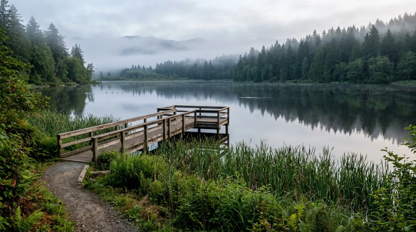
The defining feature of the area is Burnaby Lake Regional Park, a large Metro Vancouver nature reserve of more than 300 hectares at the centre of the city. It is a genuine wildlife habitat, not a manicured park. An extensive trail network circles the lake, and the park supports birdwatching, canoeing, and kayaking. Piper Spit is a pier that extends into the lake and is a popular spot to watch waterfowl and other wildlife up close, and the Burnaby Lake Nature House runs interpretive and nature programs at the lakeside.

The second half of the area's recreational identity is the Burnaby Lake Sports Complex, a major sports hub on Kensington Avenue. Kensington Avenue splits the complex into a "West" facility and an "East" facility. The artificial-turf fields are used across a wide range of sports, soccer, field hockey, field lacrosse, football, rugby, cricket, and ultimate, which makes the complex a year-round draw for teams and clubs from across the region.

The lakeside facilities extend beyond the fields. The Bill Copeland Sports Centre, an ice arena, is part of the complex, and a rowing and paddling pavilion sits at the lake. The lake itself hosts competitive rowing, which is one of the more distinctive features of central Burnaby, a genuine rowing course at the geographic middle of the city. For residents, this combination of a wild regional park and a serious sports complex means recreation is not an occasional outing but a daily backdrop.

For buyers, the practical point is that this recreation is the reason to be here. A home in the Burnaby Lake area is a home organized around the park, the trails, and the fields. The green premium on properties that genuinely sit close to the park land is real, but it is specific to those properties, and it is a different value from a home that only shares the area name a few streets away.

(03)

The Real Estate Market

The Burnaby Lake area is a mixed, supply-constrained market rather than a single uniform product. Detached single-family homes, older townhouses, and low-rise condominiums all trade under the same area label, and the right comparison for any given property depends heavily on which of those it is and where exactly it sits relative to the park. A detached home that backs onto park land is a very different proposition from a low-rise condo unit a few streets away, even though both may appear under "Burnaby Lake" in a search.

Supply is limited in a specific way. Much of the land at the centre of Burnaby around the lake is park or institutional, playing fields, the sports complex, and the regional park itself. That means residential redevelopment happens pocket by pocket rather than across a broad, uniform grid of buildable lots. The scarcity created by all that green and institutional land is part of why the quiet streets stay quiet, and it shapes how properties here are valued.

Because the housing mix is broad and prices vary widely with property type, exact location relative to the park, and condition, and because the client's guidelines prohibit publishing price ranges without a verified current source, interested buyers should contact Jersey Li directly for a current market read on specific property types. What can be said clearly is that the value of a Burnaby Lake property is driven strongly by its genuine relationship to the park and green space, not by the area label alone.

Demand is driven by families and buyers who specifically want a green, central setting, people who value the daily backdrop of the lake and the park more than they value dense walkable retail, and who are comfortable with a car-plus-transit lifestyle at the centre of Burnaby.

(04)

Living in Burnaby Lake

Daily life in the Burnaby Lake area is quiet and green, and it is organized around the lake and the park rather than around a commercial strip. There is no dense high street inside the low-density residential streets, so residents typically drive for groceries, pharmacy, and most retail, reaching commercial centres on the edges of the area. In exchange, the streets stay calm and the everyday backdrop is trees, trails, and water.

The recreation is the lifestyle here. Weekend mornings on the trails around Burnaby Lake, birdwatching from Piper Spit, canoeing and kayaking on the lake, and nature programs at the Burnaby Lake Nature House are part of the routine for the families who choose this area. For households with children in team sports, the Burnaby Lake Sports Complex on Kensington Avenue is a genuine day-to-day amenity, the fields, the Bill Copeland Sports Centre ice arena, and the rowing and paddling pavilion are all part of the local fabric.

The area is genuinely quiet after dark. This is not a nightlife setting; it is a green, residential one. For nature-loving families and buyers who want a calmer, greener pace while staying central in Burnaby, this is exactly the environment they are seeking. For younger buyers who want walkable social life and late-opening restaurants at their door, the Burnaby Lake streets would be a poor fit, and that honest assessment is part of the advisory conversation.

The car-plus-transit reality is worth being clear about. Two Millennium Line stations sit on the edges of the area, Sperling-Burnaby Lake to the northwest and Lake City Way to the northeast, so rapid transit is reachable. But from many of the low-density streets, the walk to a station is not practical for a daily commute, and most residents drive to the station or drive for errands. This is an area for households comfortable with a car-first daily pattern supported by nearby SkyTrain, rather than a transit-only lifestyle.

(05)

Redevelopment & Bill 44 Around the Lake

The RS residential streets in the Burnaby Lake area fall under BC's Bill 44 small-scale multi-unit housing legislation, which came into force in 2024. Bill 44 grants baseline multiplex rights, up to four or six units on a single residential lot, depending on lot characteristics, across most urban residential zones in the province. In principle, that means an RS lot in the Burnaby Lake area could support a small multi-unit development rather than a single-family rebuild.

The important local qualifier is that much of the land near the lake is park or institutional rather than residential. The regional park, the playing fields, and the sports complex take up a large share of the central Burnaby land around the lake, so the residential fabric is a set of pockets rather than a continuous grid of buildable lots. Redevelopment therefore happens pocket by pocket, and the question of whether Bill 44 rights are meaningful on any given property is a lot-by-lot one.

For buyers evaluating redevelopment potential on a specific Burnaby Lake property, the analysis must be done for the individual lot. Its dimensions, its zoning, its slope, and Burnaby's setback and lot-coverage rules, not from a general area statement. I run through this analysis as a standard part of my buyer advisory process, looking at the actual zoning and the specific parcel rather than the provincial legislation in the abstract.

Most buyers in this area are not buying to redevelop in the near term. They are buying to live in a green, central setting and to hold. The redevelopment optionality that Bill 44 adds is a long-term factor in land value rather than an active investment strategy for most Burnaby Lake buyers, understanding it is part of knowing what you own.

(06)

Burnaby Lake vs Government Road vs Deer Lake

Buyers looking at the green centre of Burnaby often compare Burnaby Lake with Government Road and Deer Lake, because all three are quiet, park-defined areas. The differences are real and worth mapping clearly before making a decision, because the three are genuinely distinct places that people frequently confuse.

The clearest difference is the type of park. Burnaby Lake Regional Park is a wild nature reserve of more than 300 hectares, trails circling the lake, a rowing course, birdwatching, and a real wildlife habitat. Deer Lake Park, to the southwest, is a landscaped cultural park with the Burnaby Art Gallery and a more manicured, event-oriented character. One is wilderness at the centre of the city; the other is a curated cultural green space. This single difference drives much of how each area feels day to day.

Position and buyer profile differ as well. Burnaby Lake is central, wrapping around the lake and its sports complex; Government Road is the estate-lot enclave on the north shore of the lake, defined by large single-family lots; Deer Lake is to the southwest, closer to the cultural park and to South Burnaby. A buyer who wants large estate lots is really looking at Government Road; a buyer who wants a landscaped cultural setting is looking at Deer Lake; a buyer who wants a nature-first, recreation-defined central setting with a mix of housing types is looking at Burnaby Lake itself.

On transit, all three are car-plus-transit areas rather than transit-first. Burnaby Lake has Sperling-Burnaby Lake Station on the northwest and Lake City Way Station on the northeast, both on the Millennium Line. Government Road's nearest station is also Sperling-Burnaby Lake, and Deer Lake sits closer to South Burnaby's stations. In all three, most residents on the quiet streets drive for daily errands, the green, low-density character comes with a car-dependent daily pattern.

(07)

What to Watch For When Buying in Burnaby Lake

The first thing to read carefully is exactly what "Burnaby Lake" means for the specific property. Because the area label covers detached homes, older townhouses, and low-rise condos across a green band around the lake, two listings under the same name can be very different products in very different positions. Confirm how close the property genuinely sits to the park and green space, and whether the green premium reflected in the price is real for that address or just borrowed from the area name.

Understand the supply picture around the lot. Much of the surrounding land is park or institutional, which is part of what keeps the streets quiet and limits new supply. That scarcity is generally a positive for long-term value, but it also means the pocket you are buying into may not change much over time, which is exactly what many buyers here want, but is worth confirming matches your expectations.

Review the age and condition of the property carefully, since the housing stock includes established detached homes and older townhouses. On any home more than thirty years old, look closely at the roof, mechanical systems, and drainage, and treat a pre-purchase inspection by a qualified inspector as the baseline, not an optional extra. Older townhouse and low-rise condo buildings also warrant a careful review of the strata's condition and finances.

Finally, be honest with yourself about the car-plus-transit reality before you commit. Two Millennium Line stations sit on the edges of the area, but from many of the low-density streets the walk to a station is not practical for a daily commute. If a transit-first lifestyle is important to you, confirm that the specific address actually supports it, some do, many do not. This is an area for households comfortable driving for daily errands with SkyTrain as a supporting option.

(08)

My Take as Your Advisor

Burnaby Lake is one of the central Burnaby areas I genuinely value, because it offers something specific: a green, quiet, recreation-defined setting at the geographic centre of the city. The regional park and the sports complex give the area a daily backdrop that most central neighbourhoods simply do not have. The buyers I tend to place here successfully are nature-loving families and people who want a calmer, greener pace while staying central in Burnaby, and who are comfortable with a car-plus-transit daily pattern.

The buyers I steer toward a closer look elsewhere are those who need walkable transit and a dense, walkable high street at their door. For a transit-first household, a town-centre area with a station and retail within walking distance is a better fit than most of the low-density Burnaby Lake streets, and I will say so plainly rather than sell the label.

The part of my job that matters most in this area is reading the difference between a genuine park-adjacent green premium and a home that only shares the "Burnaby Lake" name. Because the area overlaps with Government Road on the north shore, Deer Lake to the southwest, and Cariboo and Montecito to the east and southeast, I spend real time helping buyers figure out which lakeside sub-area actually fits how they want to live, rather than treating the whole green band as one uniform market.

Burnaby Lake is a market where knowing the specific property and its true relationship to the park matters more than a broad area average. The right home here, genuinely green, genuinely central, genuinely quiet, is worth being precise about, and I am happy to be the advisor who helps you get that read right.

Getting Around

Commute times from Burnaby Lake.

SkyTrain figures are in-vehicle times from TransLink's official station-to-station chart; add a few minutes for transfers and waiting. Bus and nearest-station legs are noted per row. Driving times are approximate and off-peak.

DestinationBy TransitBy Car
Sperling-Burnaby Lake Station (Millennium Line)Most residents on the low-density streets drive to the station rather than walking from their door.On the northwest edge of the area; walkable from the nearest streets, a drive from others.≈5 to 10 min off-peak from most addresses
Lake City Way Station (Millennium Line)Which of the two stations is closer depends heavily on the specific address within the area.On the northeast edge of the area; the nearest SkyTrain link for the northeast streets.≈5 to 10 min off-peak from most addresses
Downtown Vancouver (Waterfront Station)A car-plus-SkyTrain commute is the norm from the low-density streets.Drive or bus to Sperling-Burnaby Lake or Lake City Way, then Millennium Line west to Commercial-Broadway and transfer to the Expo Line to Waterfront.≈25 to 35 min off-peak via Highway 1 or Lougheed Highway
SFU Burnaby CampusThe central position keeps SFU within a reasonable drive for many addresses.Bus and SkyTrain via Sperling-Burnaby Lake Station toward the SFU bus connections.≈10 to 20 min off-peak depending on the address and route up Burnaby Mountain
Brentwood Town CentreMillennium Line from Sperling-Burnaby Lake or Lake City Way westbound.≈10 to 15 min off-peak
Metrotown (Burnaby's largest commercial hub)SkyTrain via the Millennium Line and a transfer to the Expo Line at Commercial-Broadway or via Lougheed.≈15 to 25 min off-peak
Side by Side

Burnaby Lake vs Government Road vs Deer Lake: three distinct park-defined areas people often confuse.

Burnaby LakeGovernment RoadDeer Lake
Park typeWild regional park, nature reserve, trails, rowing, wildlife habitatBacks onto Burnaby Lake Regional Park (same wild reserve, north shore)Landscaped cultural park, Burnaby Art Gallery, more manicured
Position in BurnabyCentral, wraps around the lake and the sports complexNorth shore of Burnaby Lake, estate-lot enclaveSouthwest, closer to the cultural park and South Burnaby
Housing characterMix of detached homes, older townhouses, and low-rise condosLarge single-family estate lotsLarge-lot detached homes, prestige addresses
Nearest SkyTrainSperling-Burnaby Lake and Lake City Way (Millennium Line)Sperling-Burnaby Lake (Millennium Line)Closer to South Burnaby stations
Transit realityCar-plus-transit, most drive for daily errandsCar-plus-transit, most drive for daily errandsCar-plus-transit, most drive for daily errands
Buyer profileNature-first families wanting a green, central, recreation-defined settingBuyers wanting large estate lots on the quiet north shoreBuyers wanting a landscaped cultural setting and prestige address

This comparison is qualitative positioning, not based on a verified current-date average. SkyTrain and driving times are approximate and off-peak. Contact Jersey Li for current market data.

Multiplex Outlook

What multiplex means for this neighborhood.

The RS residential streets in the Burnaby Lake area fall under BC's Bill 44 small-scale multi-unit housing legislation, which creates baseline multiplex rights (up to four or six units depending on lot characteristics) across most urban residential zones in the province. The important local qualifier is that much of the land near the lake is park or institutional, the regional park, the playing fields, and the sports complex take up a large share of the central Burnaby land around the lake. The residential fabric is therefore a set of pockets rather than a continuous grid of buildable lots, and redevelopment happens pocket by pocket. Whether Bill 44 rights are meaningful on any given property is a lot-by-lot question that depends on individual lot dimensions, zoning, slope, and Burnaby's setback and lot-coverage rules. Most Burnaby Lake buyers are purchasing to live in a green, central setting and hold long term, so the multiplex question is most relevant to those evaluating a specific lot for a custom build or future redevelopment. A lot-by-lot analysis, not an area generalization, is the right framework for any specific property.

Multiplex Advisory →
The Local Map

What's around you.

Burnaby Lake, approximate centre · map © OpenStreetMap contributorsView larger map ↗

Schools

  • Second Street Community School , Public elementary in the surrounding area, nearby, not a confirmed catchment claim; confirm current catchment directly with the Burnaby School District (School District 41)
  • Montecito Elementary , Public elementary in the surrounding area, nearby, not a confirmed catchment claim; confirm current catchment directly with the Burnaby School District (School District 41)
  • Cariboo Hill Secondary , The nearby secondary school for parts of the central/southeast area, nearby, not a confirmed catchment claim; confirm current catchment directly with the Burnaby School District (School District 41)

Parks & Recreation

  • Burnaby Lake Regional Park , Metro Vancouver nature reserve of more than 300 hectares at the centre of the city, a trail network circling the lake, birdwatching, canoeing and kayaking, a genuine wildlife habitat rather than a manicured park
  • Piper Spit , A pier extending into Burnaby Lake, a popular spot to watch waterfowl and other wildlife up close
  • Burnaby Lake Nature House , Interpretive and nature programs at the lakeside within Burnaby Lake Regional Park
  • Burnaby Lake Sports Complex , A major sports hub on Kensington Avenue, split into West and East facilities, artificial-turf fields for soccer, field hockey, field lacrosse, football, rugby, cricket, and ultimate
  • Bill Copeland Sports Centre , An ice arena among the lakeside facilities of the Burnaby Lake Sports Complex
  • Rowing & paddling pavilion (Burnaby Lake) , A lakeside pavilion supporting competitive rowing on Burnaby Lake, one of the more distinctive features of central Burnaby

Transit

  • Sperling-Burnaby Lake Station (Millennium Line) , On the northwest side of the area, at Sperling Avenue and Lougheed Highway, the nearest SkyTrain link for the northwest streets
  • Lake City Way Station (Millennium Line) , To the northeast of the area, the nearest SkyTrain link for the northeast streets
  • Car-first daily pattern , Most residents on the low-density streets drive for daily errands; from many addresses the walk to a station is not practical for a daily commute

Shopping & Dining

  • Commercial centres on the edges of the area , There is no dense high street inside the low-density streets, residents drive to commercial centres on the edges of the area for groceries, pharmacy, and most retail
  • Lake City Way area services , Grocery and service retail near Lake City Way Station on the northeast edge
  • Sperling / Lougheed Highway corridor , Retail and services reachable along the Lougheed Highway corridor near Sperling-Burnaby Lake Station on the northwest edge
Who Thrives Here

Who this neighborhood suits.

Frequently Asked

Questions buyers ask about Burnaby Lake.

What is the Burnaby Lake area in Burnaby?

+

Burnaby Lake is a quiet, green, low-density residential area at the geographic centre of Burnaby, on the land that wraps around Burnaby Lake and the Burnaby Lake Regional Park. In real-estate listings (MLS/REW), "Burnaby Lake" is used as an area name for the green residential pockets near the lake and the sports complex. Housing is a mix of established detached single-family homes, older townhouses, and some low-rise condominiums on tree-lined streets. The area's identity is built on recreation and nature, the regional park and the Burnaby Lake Sports Complex, rather than on a dense residential core.

What school catchment is the Burnaby Lake area in?

+

The exact catchment for the Burnaby Lake area is not fully verified here, so treat the following as nearby schools rather than confirmed catchment. Second Street Community School and Montecito Elementary are in the surrounding area, and Cariboo Hill Secondary is the nearby secondary school for parts of the central and southeast area. School catchment boundaries do change and are not the same as "nearest school", always confirm current enrollment eligibility directly with the Burnaby School District (School District 41) before making a purchasing decision based on school access.

What SkyTrain stations serve the Burnaby Lake area?

+

Two Millennium Line stations sit on the edges of the area: Sperling-Burnaby Lake Station on the northwest side (at Sperling Avenue and Lougheed Highway) and Lake City Way Station to the northeast. Which one is closer depends heavily on the specific address. However, most residents on the low-density streets drive for daily errands, from many addresses the walk to a station is not practical for a daily commute, so this is a car-plus-transit area rather than a transit-first one.

What is Burnaby Lake Regional Park?

+

Burnaby Lake Regional Park is a Metro Vancouver nature reserve of more than 300 hectares at the geographic centre of the city. It is a genuine wildlife habitat rather than a manicured park, with an extensive trail network circling the lake, birdwatching, and canoeing and kayaking. Piper Spit is a pier extending into the lake that is a popular spot to watch waterfowl up close, and the Burnaby Lake Nature House runs interpretive and nature programs at the lakeside. The lake also hosts competitive rowing.

What is the Burnaby Lake Sports Complex?

+

The Burnaby Lake Sports Complex is a major sports hub on Kensington Avenue, at the centre of Burnaby. Kensington Avenue splits it into a West facility and an East facility. Its artificial-turf fields are used for soccer, field hockey, field lacrosse, football, rugby, cricket, and ultimate. The lakeside facilities also include the Bill Copeland Sports Centre, an ice arena, and a rowing and paddling pavilion on Burnaby Lake. For families with children in team sports, the complex is a genuine day-to-day amenity.

How is Burnaby Lake different from Government Road?

+

They share the same lake but are distinct areas. Government Road is the estate-lot enclave on the north shore of Burnaby Lake, defined by large single-family lots. That estate character is covered on the Government Road page. The Burnaby Lake area, by contrast, is the central, recreation-defined green band that wraps around the lake and the sports complex, with a mix of detached homes, older townhouses, and low-rise condos rather than uniform estate lots. If you want large estate lots on the quiet north shore, you are really looking at Government Road; if you want a nature-first central setting with a mix of housing types, you are looking at Burnaby Lake itself.

How is Burnaby Lake different from Deer Lake?

+

The clearest difference is the type of park. Burnaby Lake Regional Park is a wild nature reserve of more than 300 hectares, trails circling the lake, a rowing course, birdwatching, and a real wildlife habitat. Deer Lake Park, to the southwest, is a landscaped cultural park with the Burnaby Art Gallery and a more manicured, event-oriented character. Burnaby Lake is central and nature-first; Deer Lake is a curated cultural green space closer to South Burnaby. A buyer who wants wilderness at the centre of the city is looking at Burnaby Lake; a buyer who wants a landscaped cultural setting is looking at Deer Lake.

Does Bill 44 apply to Burnaby Lake properties?

+

Yes, the RS residential streets in the Burnaby Lake area fall under BC's Bill 44 small-scale multi-unit housing legislation, which grants baseline multiplex rights (up to four or six units, depending on lot characteristics) on most urban residential lots in the province. The important local qualifier is that much of the land near the lake is park or institutional, so the residential fabric is a set of pockets rather than a continuous grid of buildable lots, and redevelopment happens pocket by pocket. Whether Bill 44 rights are meaningful on any given property is a lot-by-lot question that depends on the specific lot dimensions, zoning, slope, and Burnaby's setback and lot-coverage rules. Contact Jersey Li for a lot-by-lot analysis.

Is the Burnaby Lake area good for families?

+

Yes, the Burnaby Lake area suits nature-loving families who want a quieter, greener setting while staying central in Burnaby. The regional park's trails, birdwatching, and paddling are a daily backdrop, and the Burnaby Lake Sports Complex on Kensington Avenue is a genuine amenity for households with children in team sports. The trade-off is that the area is car-dependent for daily errands, and even with two SkyTrain stations on the edges, the walk to a station is not practical from many addresses. Families comfortable driving for daily errands, with SkyTrain as a supporting option, tend to be very satisfied here.

Is the Burnaby Lake area a good place to buy for the long term?

+

For buyers who value a green, quiet, central setting, it can be. Much of the surrounding land is park or institutional, which limits new supply and helps keep the quiet streets quiet, a factor that supports long-term stability for buyers who want a setting that will not change much over time. The key is to be precise about the specific property: because the area label covers detached homes, older townhouses, and low-rise condos in different positions relative to the park, the true value depends on the property's genuine relationship to the green space, not on the area name alone. Contact Jersey Li for current market data on the specific property types you are considering.

Keep Exploring

Other Burnaby neighborhoods.

Free · No Obligation

What's your Burnaby Lake home worth today?

Get a data-driven valuation from a local Burnaby expert, not an automated guess.

Considering Burnaby Lake?

Let's talk about your Burnaby Lake move.

Whether you're buying, selling, or weighing a multiplex play, I'll give you the straight read. No pressure, no obligation.

Book a Consultation
CallFree Valuation