Skip to content
JERSEY LIPERSONAL REAL ESTATE CORPORATION
Westridge / North Burnaby

Westridge, where the mountain meets the inlet.

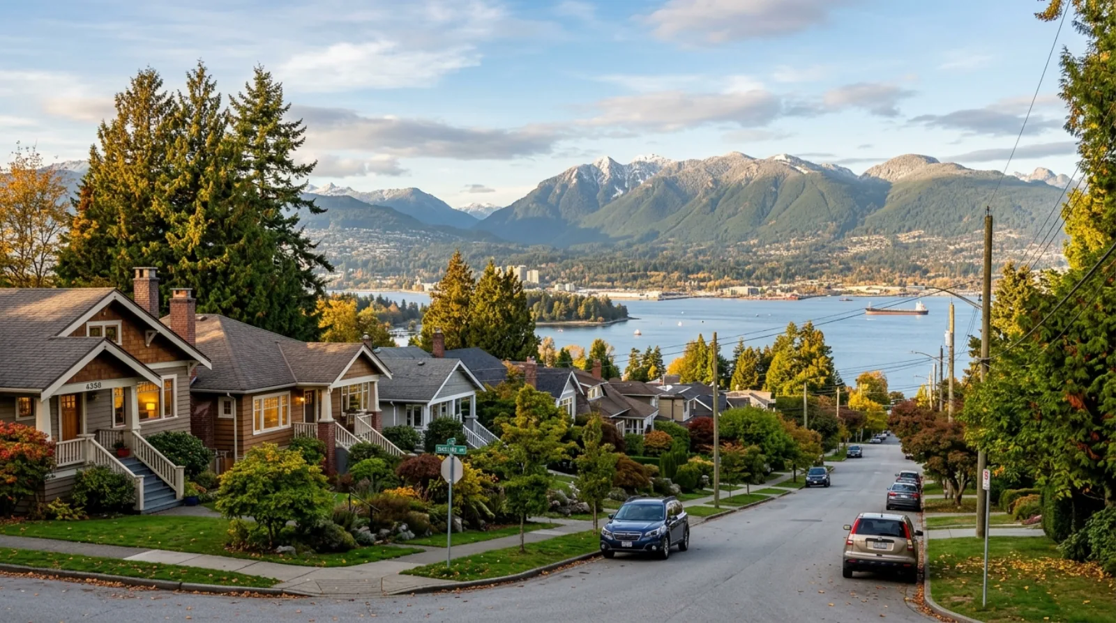
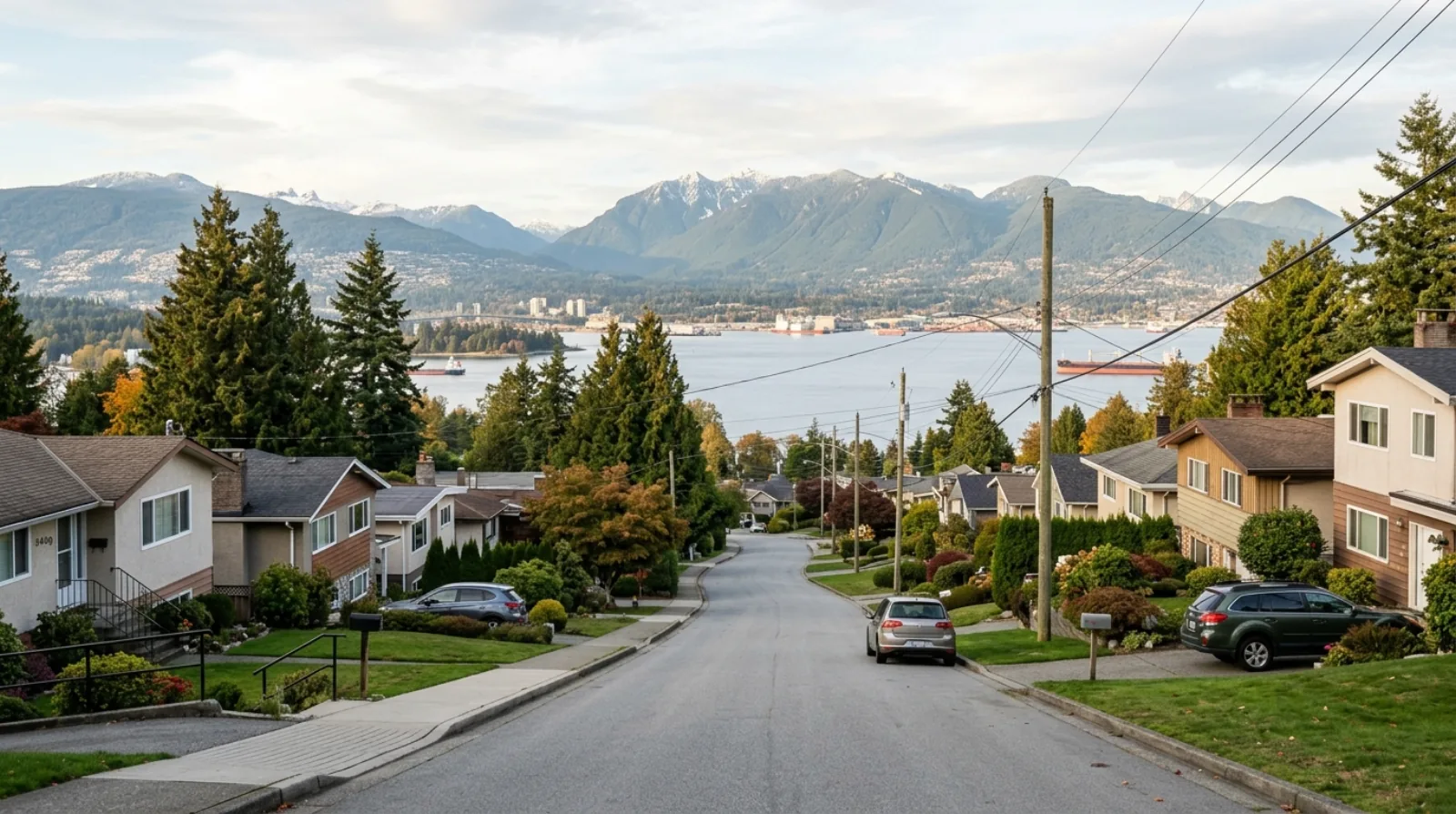
Westridge sits on the western slope of Burnaby Mountain in a corner of North Burnaby that most buyers never stumble across by accident. The neighbourhood straddles Barnet Highway between Hastings Street and the shore of Burrard Inlet, and it divides naturally into two distinct halves along Inlet Drive. The lower, western half is a 1950s subdivision of post-war single-family homes on gentle streets close to the waterfront. The upper, eastern half climbs steeply up the mountain on larger lots, with a few low-rise units mixed in among the houses. What holds both halves together is the view: Burrard Inlet and the North Shore mountains stretch out to the west, and Burnaby Mountain Conservation Area rises behind. Simon Fraser University is minutes away by car, Barnet Marine Park is the neighbourhood's weekend anchor, and Burnaby Heights along Hastings Street covers most everyday shopping needs. Westridge is genuinely quiet in a way that established North Burnaby neighbourhoods rarely manage — it is a place people choose deliberately, and rarely leave in a hurry.

Jersey LiSutton Group — 1st West RealtyMedallion ClubUpdated
Westridge, Burnaby
HousingPost-war and renovated single-family detached homes
MultiplexR1 small-scale multi-unit (Bill 44) — most lots eligible for up to 4 units
Quick Answer

Westridge is a quiet, established residential neighbourhood in northeast Burnaby, located on the western slope of Burnaby Mountain between Hastings Street and Burrard Inlet. It consists mostly of post-war and renovated single-family detached homes on two distinct tiers divided by Inlet Drive — a lower, flatter western section near the waterfront and a steeper eastern section climbing the mountain. It has no SkyTrain; transit is by bus (R5 Hastings, Route 160, Route 144). Barnet Marine Park is the neighbourhood's main outdoor amenity, and Burnaby Heights along Hastings Street is the nearest shopping district. The Trans Mountain Westridge Marine Terminal operates at the waterfront edge of the neighbourhood.

Key Takeaways
  • 01Westridge is on the western slope of Burnaby Mountain in northeast Burnaby, bounded by Hastings Street to the south and Burrard Inlet to the north.
  • 02Housing is predominantly post-war single-family detached homes, with many renovated and updated; there is minimal condo or apartment stock in the neighbourhood core.
  • 03The neighbourhood has no SkyTrain access; primary transit connections are the R5 Hastings RapidBus (stops at Duthie Avenue) and Route 160 along Inlet Drive and Barnet Highway.
  • 04Barnet Marine Park — a 1.5-kilometre stretch of sandy waterfront on Burrard Inlet — is the neighbourhood's most distinctive amenity, offering swimming, kayaking, picnicking, and views of Indian Arm.
  • 05Simon Fraser University is reachable in roughly 15 minutes by car or bus via Burnaby Mountain Parkway, making the neighbourhood practical for SFU staff and faculty.
  • 06Under Bill 44 (provincial small-scale multi-unit housing legislation), most R1-zoned lots in Westridge are eligible for up to four units, which adds a quiet redevelopment floor to detached home values.
Your Westridge Agent

Your Westridge real estate agent — Jersey Li.

Westridge is a thin-inventory neighbourhood where a well-located home with inlet views can trade at a meaningful premium — and a poorly positioned one on the wrong side of Inlet Drive can sit for months. Understanding that difference requires knowing the streets, the lot grades, and which exposures actually deliver an unobstructed sightline versus a partial glimpse between rooftops. That is the kind of building-by-building read I bring to every listing and purchase in this part of North Burnaby.

Older homes in Westridge often carry deferred maintenance that isn't obvious in photos or during a casual showing: aging plumbing, original electrical panels from the 1950s and 1960s, foundation drainage on the mountain's steeper sections, and wood-frame construction that needs careful inspection. I walk buyers through what to look for and when to push for price concessions versus when a house is genuinely solid — so you don't overpay for problems or walk away from a good home over fixable issues.

For sellers, pricing correctly in a quiet market like Westridge matters more than in high-turnover neighbourhoods. There are rarely enough comparables to just run a number mechanically. I look at lot position, view quality, renovation standard, and the Bill 44 redevelopment potential of the lot itself — and I give you a straight-line opinion on price, not one inflated to win the listing.

  • Deep knowledge of North Burnaby's older single-family market — lot grades, view corridors, and due-diligence priorities in post-war construction
  • Bill 44 multiplex analysis for Westridge lots: assessing which properties carry real redevelopment value versus theoretical eligibility
  • Fluent service in English, Mandarin, and Cantonese — relevant for the North Burnaby buyer base with ties to SFU and the broader Burnaby community
  • Medallion Club agent (top 10% REBGV) — Sutton Group — 1st West Realty
Jersey LiSutton Group — 1st West RealtyMedallion ClubLicensed (RECBC)
Work with Jersey in Westridge
On This Page
(01)

The Westridge Character

Westridge is one of the quieter and less-publicised neighbourhoods in North Burnaby. It sits in the northeast corner of the city, on the western face of Burnaby Mountain, between the commercial activity of Hastings Street to the south and the waterfront of Burrard Inlet to the north. Inlet Drive cuts through the middle and defines the two distinct halves of the neighbourhood: west of Inlet Drive, the terrain flattens and the homes sit closer to the shore; east of Inlet Drive, the lots climb steeply up the mountain on larger parcels with more tree cover and more dramatic views.

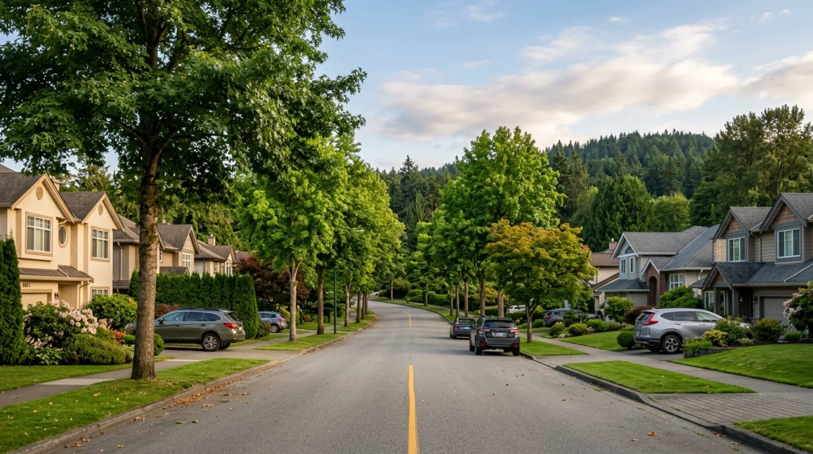
The housing stock reflects two eras of suburban development. The western, lower section was built primarily in the 1950s — a typical post-war single-family subdivision with modest homes on standard lots, many of which have been renovated or expanded significantly since. The eastern, upper section developed in the 1970s, with larger lots, more varied architecture, and a small number of low-rise units mixed among the detached homes. What both sections share is a settled, low-turnover character: families and long-term owners who chose the neighbourhood for its combination of proximity to SFU, access to Barnet Marine Park, and quiet streets that feel removed from the busier parts of North Burnaby.

The Trans Mountain Westridge Marine Terminal operates at the waterfront edge of the neighbourhood, connected to the Burnaby Terminal by an underground tunnel through Burnaby Mountain. The terminal is an industrial facility and is not part of the residential fabric; it sits at the north end of the neighbourhood near the Barnet Highway corridor. Most Westridge residents live their daily lives without much interaction with the terminal, which operates on the water side of the highway. It is worth knowing it exists when assessing the neighbourhood, and worth being factual about its function.
(02)

The Real Estate Market

Westridge is a low-inventory detached-home market. Active listings in any given month are small in number — this is not a neighbourhood where you will find dozens of comparables to anchor a price decision. That thinness cuts both ways: sellers with a well-positioned home and a view can command a premium because there is nothing to compare against, but buyers without a local read can overpay for a house that simply lacks alternatives at the moment of listing.

The market here is driven primarily by detached single-family homes. Condos and apartments are a small minority of the stock, mostly in the older low-rise buildings in the eastern section. Townhouses are rare. For buyers, this means the relevant decision is almost always about a detached home on a particular street at a particular grade, not about choosing between housing types.

Bill 44's small-scale multi-unit legislation has added a quiet but real floor beneath many Westridge detached values. Most R1-zoned lots in the neighbourhood meet the provincial criteria for up to four units, which means that even a tired house on a standard lot carries some redevelopment optionality that was not priced in before 2023. Whether that optionality is actionable depends on the specific lot dimensions, grades, and existing structure — it is worth assessing on a property-by-property basis rather than assuming it applies uniformly.

Days on market for correctly priced homes in Westridge can be longer than in higher-turnover North Burnaby streets like Burnaby Heights or Capitol Hill. Buyers for this neighbourhood are making a deliberate lifestyle choice — they are not incidentally landing here — and the pool is correspondingly smaller. Patience and honest pricing both matter more here than in a seller's market with broad appeal.

(03)

Living in Westridge

Day-to-day life in Westridge is quiet and primarily car-dependent for most errands. Hastings Street and the Burnaby Heights shopping district are a short drive south, covering groceries, restaurants, and everyday services. For residents without a car, the R5 Hastings RapidBus runs along Hastings Street with a stop at Duthie Avenue, providing reasonable access to Burnaby Heights and connections toward downtown Vancouver. Route 160 serves Inlet Drive and Barnet Highway for commuters heading toward Port Moody and Coquitlam.

Barnet Marine Park is the neighbourhood's most important outdoor asset. The park runs approximately 1.5 kilometres along the Burrard Inlet shoreline with sandy beaches, grassy picnic areas, a seasonal café, kayak and canoe launch facilities, an off-leash dog area, and views across the inlet to Indian Arm and the North Shore. On summer weekends, the park draws families from across North Burnaby and beyond, but Westridge residents have the practical advantage of being able to walk there in a few minutes.

Burnaby Mountain Conservation Area and SFU are accessible from the upper eastern part of the neighbourhood. The conservation area covers 576 hectares of forested terrain above the residential streets, with hiking and walking trails that connect to the SFU campus. Wildlife — including black bears, which occasionally visit backyards backing onto the forest edge — is a genuine feature of life in the upper portion of the neighbourhood. This proximity to a large forested conservation area is unusual for a residential neighbourhood this close to the city, and it shapes the character of the upper streets in a real way.

The honest tradeoff in Westridge is convenience. There are no grocery stores within walking distance of most of the neighbourhood, no café strip, and no transit option that replaces a car for households with multiple daily trips. Westridge works well for people who value quiet, nature access, and a settled residential character, and who are comfortable driving or taking the bus for most daily needs.

(04)

Westridge vs Capitol Hill vs Government Road

Buyers considering North Burnaby's established single-family neighbourhoods often compare Westridge, Capitol Hill, and Government Road. All three are low-density, detached-home areas with long-term-owner character and proximity to Hastings Street. The differences are real and practical.

Capitol Hill sits on the rise west of Hastings Street, closer to the Brentwood and Burnaby Heights commercial corridors. It has more frequent bus service, faster access to SkyTrain (via Brentwood or Gilmore stations), and a denser grid of streets. It is the most convenient of the three for car-free or transit-dependent households and tends to be more active on resale because of broader buyer appeal. The views from the top of Capitol Hill toward downtown Vancouver are strong, though they differ from Westridge's inlet-facing exposures.

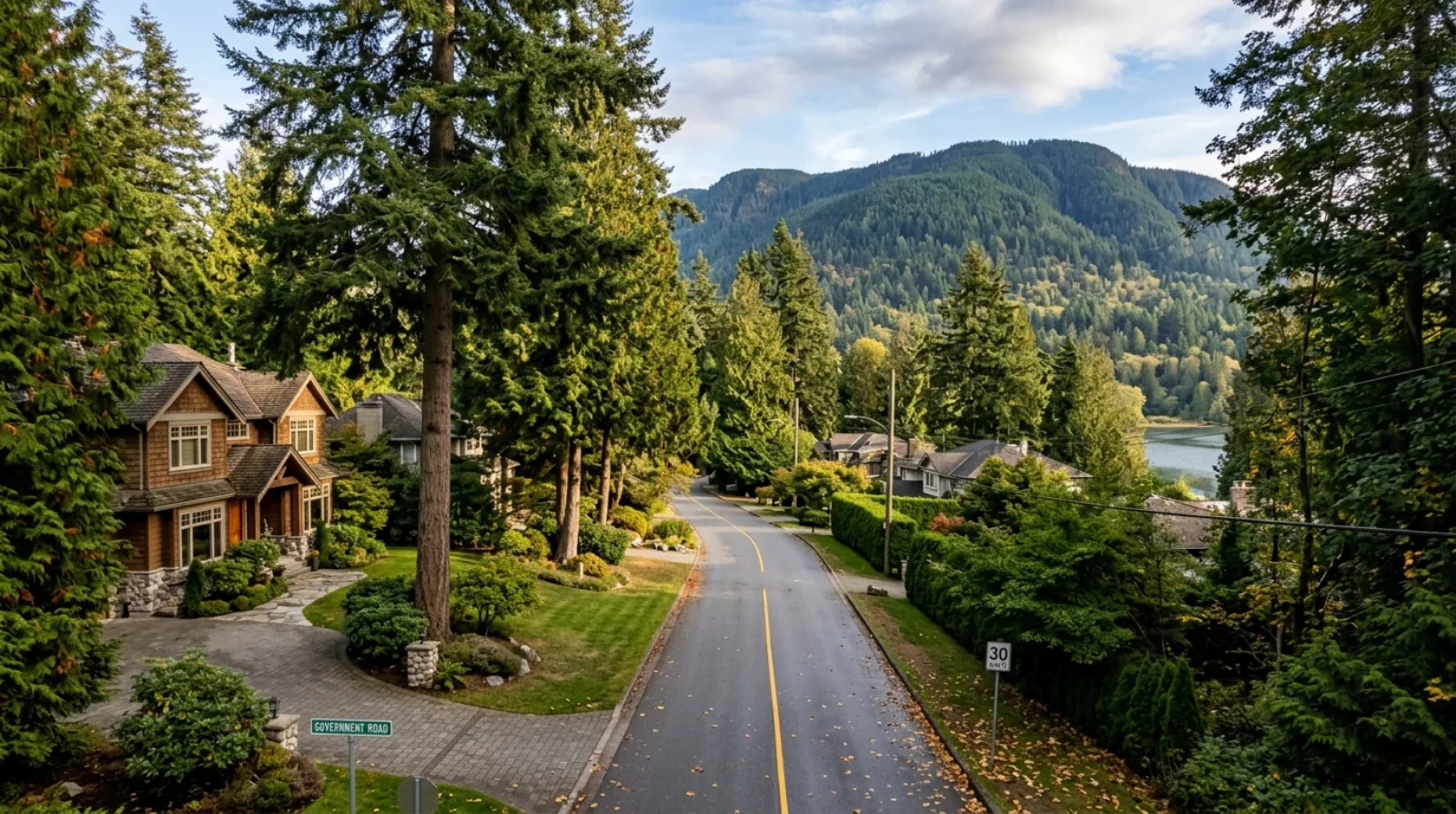
Government Road is on the south face of Burnaby Mountain near Burnaby Lake, farther from the waterfront but close to three SkyTrain stations — Sperling, Lake City, and Production Way–University. It has a lakeside, forested setting and a notably calm character, with high owner-occupancy rates and larger lots on average. It appeals to buyers who want proximity to SkyTrain without the density of a Town Centre, and to SFU faculty and staff commuting up the mountain.

Westridge is the most distinctively waterfront-adjacent of the three, with the strongest inlet views from the right streets, the most direct access to Barnet Marine Park, and the closest feel to a small, self-contained community that was built in one or two eras and has not changed dramatically since. It is also the furthest from SkyTrain and the most car-dependent. Buyers who weight view and waterfront access above transit convenience will find Westridge has a quality that the other two cannot match; buyers who weight commute and walkability will be better served by Capitol Hill or Government Road.

(05)

Barnet Marine Park

Barnet Marine Park is the single feature that most distinguishes Westridge from other North Burnaby residential neighbourhoods. The park runs along the Burrard Inlet shoreline for approximately 1.5 kilometres, with sandy beaches, grassy picnic lawns, changing facilities, outdoor showers, BBQ stations, a seasonal café, and launch facilities for canoes, kayaks, and sailing craft. An off-leash dog area, walking and jogging paths on crushed limestone and paved surface, and benches placed for inlet views complete the amenities.

The park's location — directly accessible from the western portion of Westridge — means that for residents in the lower streets, a Saturday morning walk to the beach is a ten-minute trip on foot. Across the inlet, Indian Arm extends northward with views of the mountains above North Vancouver. On clear days, the park provides one of the most open waterfront perspectives in Burnaby, without the crowds of Stanley Park or the restricted access of the industrial waterfront east of Port Moody.

The park is operated by the City of Burnaby and is open year-round. Summer draws the largest crowds, including families using the beach for swimming and wading, but the walking paths and dog area draw regular users through all seasons. For buyers assessing Westridge, proximity to Barnet Marine Park is a real quality-of-life factor that does not show up in price-per-square-foot comparisons but is consistently named by residents as a primary reason they chose the neighbourhood.

(06)

SFU, Burnaby Mountain, and the Conservation Area

Simon Fraser University sits at the top of Burnaby Mountain, approximately 15 minutes by car from Westridge via Burnaby Mountain Parkway. The campus is also accessible by bus — Route 144 connects SFU Exchange to Metrotown, and the R5 provides a connection via Hastings Street. For SFU faculty, staff, and graduate students who want to live off-campus in a quiet residential setting while staying close to the university, Westridge is one of the closer established neighbourhoods in Burnaby.

Burnaby Mountain Conservation Area covers the forest above and around the upper residential streets of Westridge. Trails from the upper neighbourhood connect into the conservation area's hiking network, which in turn links to the SFU campus and to Burnaby Mountain Park at the summit. The 576-hectare protected area includes old-growth and second-growth forest, scenic viewpoints, and wildlife habitat. Black bears are a documented presence in the conservation area and occasionally move into the adjoining residential streets — particularly in the upper, eastern portion of Westridge — which is worth being aware of when choosing a property near the forest edge.

The proximity to SFU and the conservation area adds a dimension to Westridge that purely suburban neighbourhoods lack. The upper streets feel like a residential edge between city and forest, and the hiking access is genuine rather than symbolic. This is part of what makes Westridge attractive to a specific buyer type: people who want urban proximity without giving up direct daily access to nature.

(07)

What to Watch For When Buying in Westridge

Lot position and grade matter significantly in Westridge. In the lower, western section, flat or gently sloping lots on streets perpendicular to the inlet tend to have the clearest view corridors. In the upper, eastern section, the steeper grades can create drainage and foundation considerations that require specific inspection — not a dealbreaker, but a known variable in 1950s and 1970s construction on hillside lots in Burnaby.

Older homes in Westridge frequently have original or partially updated electrical and plumbing systems. A home that looks renovated on the surface may still have a 60-amp panel, galvanized supply lines, or ABS drain lines that are reaching the end of their reliable service life. A thorough building inspection with a focus on the mechanical systems is not optional in this neighbourhood — it is the core due-diligence step.

Bill 44 multiplex potential varies by specific lot. Not every lot in Westridge will pencil for a four-unit project — slope, setback requirements, existing structure, and lot dimensions all affect feasibility. If you are buying with redevelopment in mind, have the lot assessed specifically rather than assuming provincial eligibility translates to practical viability.

Ask about the West Coast Express railway along the waterfront edge of the neighbourhood. Trains run on a commuter schedule, and most Westridge residents are far enough from the tracks that noise is not a daily issue — but the lower streets closest to Burrard Inlet are nearer to the corridor, and it is worth checking during a full day's visit rather than only a midday showing.

(08)

My Take as Your Advisor

Westridge is a neighbourhood for buyers who know what they want. The people who thrive here are not looking for walkability scores, SkyTrain stops, or a neighbourhood that is transforming — they are looking for a quiet, established residential street with genuine nature access, inlet views, and a settled community that will not look dramatically different in ten years. For that profile, Westridge delivers something that is increasingly rare in North Burnaby.

The buyers I tend to steer elsewhere are those whose daily routine requires transit or who are not comfortable relying on a car for groceries and errands. The neighbourhood is not hostile to transit users, but one bus line along Hastings and a connector along Barnet Highway is not a substitute for SkyTrain proximity. If frequent, fast transit is a priority, Capitol Hill or Government Road will serve you better.

On the purchase side, my consistent advice in Westridge is to not rush, to inspect thoroughly, and to understand the specific lot before committing. Inventory is thin enough that there is always pressure to move quickly on the right house — but post-war construction with partial updates has enough variables that the cost of a poor inspection decision here can be substantial. I have seen buyers regret speed in this neighbourhood more than patience.

Westridge is also worth watching from a longer-term perspective as a Bill 44 holding. A family that buys a solid detached home here and holds it for ten or fifteen years has a property that may eventually support a multiplex project as the neighbourhood slowly absorbs the new provincial zoning framework. That is not a near-term play, and I would not buy here primarily for that reason — but it adds a real layer of optionality to what is otherwise a straightforward lifestyle purchase.

Getting Around

Commute times from Westridge.

SkyTrain figures are in-vehicle times from TransLink's official station-to-station chart; add a few minutes for transfers and waiting. Bus and nearest-station legs are noted per row. Driving times are approximate and off-peak.

DestinationBy TransitBy Car
Downtown Vancouver (Waterfront)No direct SkyTrain; bus is the primary transit option. Driving is the faster choice for most Westridge households.Approximately 45–55 min — R5 RapidBus from Hastings/Duthie to downtown Burrard, or connect to SkyTrain at Gilmore/Brentwood for a faster leg. Times are approximate.≈25–40 min off-peak via Hastings St or Highway 1
SFU (Burnaby Mountain)One of the closest established residential neighbourhoods to SFU by car.Approximately 20–30 min by bus — R5 to Hastings, connect to Route 144 toward SFU Exchange. Times are approximate.≈12–15 min off-peak via Burnaby Mountain Parkway
Brentwood Town Centre (SkyTrain)Brentwood Town Centre Station (Millennium Line) provides onward connections once you reach it.Approximately 20–30 min by bus — R5 along Hastings to Brentwood area. Times are approximate.≈12–18 min off-peak
Port Moody / Moody CentreWest Coast Express at Moody Centre provides fast rail to downtown Vancouver for peak-hour commuters.Approximately 20–30 min via Route 160 east along Barnet Highway. Times are approximate.≈10–15 min off-peak east via Barnet Highway
MetrotownApproximately 40–55 min by bus with transfers. Times are approximate.≈20–30 min off-peak
YVR / Vancouver AirportRoughly 75–90 min with bus and SkyTrain transfers. Times are approximate.≈35–50 min off-peak
Side by Side

Westridge vs Capitol Hill vs Government Road: established North Burnaby single-family neighbourhoods.

WestridgeCapitol HillGovernment Road
LocationWestern slope of Burnaby Mountain, northeast Burnaby near Burrard InletNorth Burnaby hilltop west of Hastings, near Confederation ParkSouth face of Burnaby Mountain near Burnaby Lake
Primary housing stockPost-war (1950s) and 1970s single-family detached homesMixed post-war and newer single-family homes, some condos near HastingsSingle-family detached homes on larger lots, some duplexes
SkyTrain accessNone — nearest stations 10–12 min drive (Holdom, Production Way)Moderate — Brentwood/Gilmore stations 10–15 min by bus or driveGood — Sperling, Lake City, Production Way–University within 5–10 min drive
Primary outdoor assetBarnet Marine Park (waterfront beach, Burrard Inlet)Confederation Park (pool, sports, dog off-leash)Burnaby Lake Regional Park (nature trails, birding)
View qualityBurrard Inlet and North Shore mountains from upper and waterfront-facing streetsDowntown Vancouver and North Shore from summit streetsForested mountain and lake views; less open-water exposure
CharacterQuietest; most self-contained; low turnover; car-dependentConvenient; more connected; broader buyer poolCalm, lakeside feel; high owner-occupancy; well-connected by transit

Transit times are approximate and reflect off-peak conditions. SkyTrain station distances are driving estimates. Neighbourhood character descriptions reflect general observed patterns, not official city designations.

Multiplex Outlook

What multiplex means for this neighborhood.

Most single-family lots in Westridge are zoned R1 under Burnaby's zoning bylaw and fall within the scope of Bill 44 (provincial small-scale multi-unit housing legislation), which means they are eligible in principle for up to four residential units. The practical picture is more varied: the steeper lots on the eastern, upper section of the neighbourhood can face setback and grade constraints that reduce what is actually buildable, while flatter lots in the lower western section tend to be more straightforward for infill development. For buyers interested in the multiplex angle, the first step is a lot-specific assessment of dimensions, grade, existing structure, and servicing — not a blanket assumption that every Westridge address supports a four-unit project. I do this analysis as part of my buyer advisory work for properties where redevelopment potential is part of the decision.

Multiplex Advisory →
The Local Map

What's around you.

Westridge — approximate centre · map © OpenStreetMap contributorsView larger map ↗

Schools

  • Westridge Elementary — 510 Duncan Ave — the neighbourhood's own K-7 school, part of Burnaby School District 41
  • Alpha Secondary School — 4600 Parker St — one of the two secondary schools serving the Westridge catchment; offers French Immersion
  • Burnaby North Secondary School — 751 Hammarskjold Dr — the second secondary option for Westridge catchment students; large school with broad academic programs
  • Confederation Park Elementary — Nearby North Burnaby elementary serving adjacent catchments west of Westridge
  • Simon Fraser University — Top of Burnaby Mountain, approximately 15 min by car via Burnaby Mountain Parkway — also accessible by Route 144 bus

Parks & Recreation

  • Barnet Marine Park — 1.5 km of sandy waterfront on Burrard Inlet with beach, kayak launch, picnic areas, dog off-leash zone, and seasonal café
  • Westridge Park — Neighbourhood park near Inlet Drive and Hastings — children's playground, wading pool (seasonal), and tennis courts
  • Burnaby Mountain Conservation Area — 576 hectares of forested trails and viewpoints directly above the upper residential streets — connects to SFU campus
  • Kensington Park — Approx. 62 acres of green space in North Burnaby, a short drive west — pitch-and-putt golf, sports facilities, and walking paths
  • Confederation Park — Large regional park with pool, fitness centre, running track, skatepark, and waterpark — short drive west along Hastings
  • Duthie-Union Park — Small neighbourhood park at the south edge of Westridge near Duthie Avenue

Transit

  • R5 Hastings Street RapidBus — Stops at Duthie Avenue on Hastings Street — connects west to downtown Vancouver and east toward SFU, Coquitlam, Port Coquitlam
  • Route 160 (Hastings / Barnet Highway) — Runs along Inlet Drive and Barnet Highway — connects to Kootenay Loop and Port Coquitlam Station; useful for eastbound commuters
  • Route 144 (SFU Exchange / Metrotown Station) — Connects SFU at the top of Burnaby Mountain to Metrotown — accessible via Hastings for Westridge residents
  • No SkyTrain in Westridge — Nearest SkyTrain stations are Holdom (Millennium Line, approx. 10–12 min drive) and Production Way–University (Millennium Line, approx. 10 min drive)
  • West Coast Express — Commuter rail runs along the waterfront edge of the neighbourhood — nearest station is Port Moody, not within walking distance of Westridge residential streets

Shopping & Dining

  • Burnaby Heights (Hastings Street corridor) — The nearest everyday shopping district, 5–10 min by car or bus south on Hastings — 330+ shops, independent cafés, Valley Bakery, Cioffi's Meat Market, groceries, and restaurants
  • Kensington Square — Small neighbourhood-scale shopping plaza on Kensington Avenue — groceries, pharmacy, and everyday services
  • Loblaws / Real Canadian Superstore (Hastings St) — Full-service grocery option accessible via Hastings Street, a short drive west of the neighbourhood
  • Port Moody retail (Barnet Highway east) — Newport Village in Port Moody, approximately 10–12 min east by car — independent restaurants, Thrifty Foods, and specialty shops
  • The Amazing Brentwood — Major retail and dining hub approximately 15 min by car or bus — T&T Supermarket, Whole Foods (SOLO District), dining and lifestyle tenants
  • Barnet Marine Park Café — Seasonal café within the park at the waterfront — limited food and beverages, open in summer months
Who Thrives Here

Who this neighborhood suits.

Frequently Asked

Questions buyers ask about Westridge.

Where exactly is Westridge in Burnaby?

+

Westridge is in northeast Burnaby, on the western slope of Burnaby Mountain. It sits between Hastings Street to the south and Burrard Inlet to the north, along the Barnet Highway corridor. Inlet Drive divides the neighbourhood into a lower, flatter western section near the waterfront and a steeper eastern section that climbs the mountain. Simon Fraser University is to the east at the top of the mountain, and Port Moody is a short distance east along Barnet Highway.

What kind of homes are in Westridge, Burnaby?

+

The majority of homes in Westridge are single-family detached houses. The lower western section was developed primarily in the 1950s and consists of post-war homes, many of which have been renovated or expanded. The upper eastern section features homes built mainly in the 1970s, with larger lots and some low-rise apartment units. Townhouses and condos are rare in the neighbourhood core. It is an established, owner-occupied community with relatively low turnover.

Is there SkyTrain in Westridge?

+

No, Westridge does not have SkyTrain access. The neighbourhood is served by bus — primarily the R5 Hastings Street RapidBus (with a stop at Duthie Avenue on Hastings Street) and Route 160 along Inlet Drive and Barnet Highway. The nearest Millennium Line SkyTrain stations are Holdom and Production Way–University, both approximately 10–12 minutes by car. For households that need frequent SkyTrain access, Capitol Hill or Government Road offer more convenient options.

What is Barnet Marine Park?

+

Barnet Marine Park is a City of Burnaby waterfront park on the south shore of Burrard Inlet, at the north end of Westridge. The park stretches approximately 1.5 kilometres along the water with sandy beaches, grassy picnic areas, kayak and canoe launch facilities, an off-leash dog area, a seasonal café, outdoor showers, BBQ stations, and paved and crushed-limestone walking paths. It offers open views across Burrard Inlet toward Indian Arm and the North Shore mountains. For Westridge residents in the lower western streets, the park is walkable in a few minutes.

What is the Trans Mountain Westridge Marine Terminal?

+

The Trans Mountain Westridge Marine Terminal is an oil export facility at the waterfront edge of the Westridge neighbourhood, operated by Trans Mountain Corporation as the western terminus of the Trans Mountain pipeline system. The terminal has three vessel loading berths and exports crude oil via tanker vessels. It is connected to the Burnaby Terminal (higher up on Burnaby Mountain) by an underground tunnel. The terminal is an industrial facility on the water side of Barnet Highway and is not part of the residential fabric of the neighbourhood. Most Westridge residents live without day-to-day interaction with the terminal.

What secondary schools serve Westridge?

+

Students from Westridge Elementary feed into two Burnaby School District 41 secondary schools: Alpha Secondary School at 4600 Parker Street, which offers French Immersion programs, and Burnaby North Secondary School at 751 Hammarskjold Drive. Both are public schools. Families should confirm current catchment boundaries with the Burnaby School District directly, as boundaries can change.

How close is Westridge to SFU?

+

Westridge is one of the closer established residential neighbourhoods to Simon Fraser University. By car via Burnaby Mountain Parkway, the SFU Burnaby campus is approximately 12–15 minutes from most Westridge streets. By bus, the trip takes roughly 20–30 minutes using a combination of the R5 RapidBus and Route 144. This proximity makes Westridge a practical choice for SFU faculty, staff, and graduate students who want to live in a quiet residential neighbourhood rather than in student-oriented areas closer to the campus.

Does Bill 44 apply to Westridge homes?

+

Most single-family lots in Westridge are zoned R1 and are in principle eligible under Bill 44 (BC's small-scale multi-unit housing legislation) for up to four residential units. However, eligibility under the provincial legislation does not automatically mean every lot is practically buildable for a four-unit project. Steeper lots in the upper eastern section face setback, grade, and servicing constraints that can reduce what is actually achievable. If you are buying with multiplex development in mind, get a lot-specific assessment rather than assuming the provincial eligibility translates directly to a viable project.

Are there bears in Westridge?

+

Black bears have been documented in Burnaby Mountain Conservation Area, which borders the upper eastern portion of Westridge. Bears occasionally move from the forest into adjacent residential backyards, particularly in the streets closest to the conservation area boundary. The City of Burnaby and Metro Vancouver have information on living with urban wildlife, including bear attractant reduction. For buyers purchasing a property that backs directly onto the conservation area or forested edge, it is worth factoring wildlife presence into property selection and everyday outdoor habits.

Is Westridge a good neighbourhood for families?

+

Westridge works well for families who value quiet streets, outdoor access, and a neighbourhood school within the community. Westridge Elementary is located in the neighbourhood itself, Barnet Marine Park is walkable for lower-street residents, and trails into Burnaby Mountain Conservation Area are accessible from the upper streets. The tradeoff is car-dependence for most daily errands and limited transit for older children who need to travel independently. Families who own a car and prioritise nature access and settled character over walkability and transit tend to thrive here.

Keep Exploring

Other Burnaby neighborhoods.

Free · No Obligation

What's your Westridge home worth today?

Get a data-driven valuation from a local Burnaby expert — not an automated guess.

Considering Westridge?

Let's talk about your Westridge move.

Whether you're buying, selling, or weighing a multiplex play, I'll give you the straight read. No pressure, no obligation.

Book a Consultation
CallFree Valuation